This repository contains generator.py which generates maps and pathfinder.py (Jump to) which allows users to implement a path finding alorithm on a generated map.
generator.py generates a random map within the official Duckietown Specifications (section 2) to be used in Gym-Duckietown.
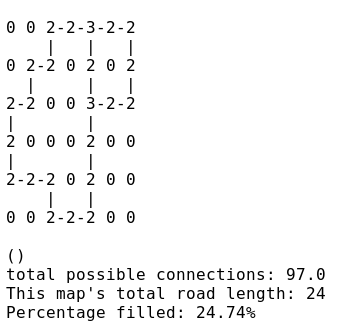
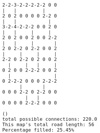
- Generation of the road network using a backtracking algorithm according to the parameters entered in map_output (terminal output shown):
- Note: in the terminal, each node is marked by its degree
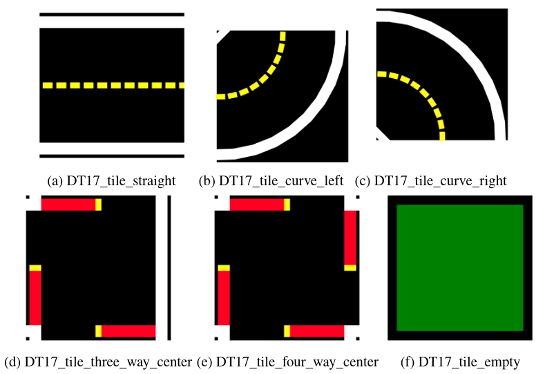
- This file creates an undirected cyclic graph, which when exported to map_output.py is translated to a 2D array of tiles selected from the following tile types:
- empty
- straight
- curve_left
- curve_right
- 3way_left (3-way intersection)
- 3way_right
- 4way (4-way intersection)
- asphalt
- grass
- floor (office floor)
(Taken from Gym-Duckietown's README)
- Writing of the road network to yaml file (output.yaml) using the map format described in Gym-Duckietown's README:
- Population of the map with objects
- Objects selected from the following object types:
- barrier
- cone (traffic cone)
- duckie
- duckiebot (model of a Duckietown robot)
- tree
- house
- truck (delivery-style truck)
- bus
- building (multi-floor building)
- sign (many types)
(Taken from Gym-Duckietown's README)
- Writing of the objects that were generated to output.yaml
In order to run this program you must have a working installation of Python 2.7+. The output is meant to be used with the gym-duckietown simulator, which has its own set of dependencies.
This program can be run by entering the following in a terminal while in the map-utils directory:
./generator.py --height <height> --width <width> --no-intersections --map-density <valid string> --no-border --side-objects <valid string> --road-objects <valid string> --hard-mode --sign-output --matrix-output
or
./generator.py --map-name <file.yaml> --no-intersections --map-density <valid string> --no-border --side-objects <valid string> --road-objects <valid string> --hard-mode --sign-output --matrix-output
Required arguments:
--map-name: a .yaml file specifying a map on which to place objects- must adhere to the Duckietown simulator map format (see gym-duckietown)
OR
--width: anintdescribing the width of the map- width must be at least 3
- this argument is required if a file is not specified with
--map-name
--height: anintdescribing the height of the map- height must be at least 3
- this argument is required if a file is not specified with
--map-name
Optional arguments:
-
--no-intersectionsor-ni: if specified, the map generated will have no intersections (AKA a closed course). Otherwise, intersections will be allowed. -
--map-densityor-md: specifies how densely packed the road network will be- valid input strings:
"any"(default)"sparse""medium""dense"
- if nothing is inputted, or the string is invalid, the map will be of density
"any" - if the map is under a size of 7x7, any density entered will be ignored
- valid input strings:
-
--no-borderor-nb: if specified, the map generated will not have a border when output. Otherwise, it will be output with a border of empty tiles (grass, floor, or asphalt, chosen at random). -
--side-objectsor-so: specifies the density of objects on non-driveable tiles- valid input strings:
"empty""any""sparse""medium"(default)"dense"
- valid input strings:
-
--road-objectsor-ro: specifies the density of objects on driveable tiles- valid input strings:
"empty"(default)"any""sparse""medium""dense"
- valid input strings:
-
--hard-mode:- "Normal mode" (default): no objects on tiles adjacent to a curve already containing an object, or adjacent to an intersection
- Hard mode: objects on any tile except for intersections
-
--sign-output: outputs sign_output.yaml, a feature-based map of signs to be used for navigationIDrepresents april tag IDs according to the signage specifications
ex. sign_output.yaml
signs:

- kind: sign_yield
  pos: [5.45, 1.0]
  rotate: 132.03
  ID: 2

- kind: sign_yield
  pos: [2.81, 2.0]
  rotate: 33.02
  ID: 2

- kind: sign_pedestrian
  pos: [5.4, 1.0]
  rotate: 45.49
  ID: 12

- kind: sign_pedestrian
  pos: [1.83, 3.0]
  rotate: 0.0
  ID: 12

- kind: sign_pedestrian
  pos: [1.83, 4.0]
  rotate: 180.0
ID: 12--matrix-output: outputs adj_matrix.npz, a file containing:- out: a NumPy adjacency matrix of the generated road network
- dims: a tuple of
(height, width)for reconversion into a regular node graph or other representations
Ex. 1
./generator.py 7 5 --no-border --side-objects "medium" --road_objects "medium"
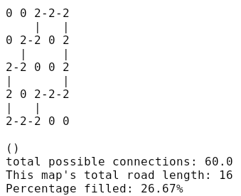
Outputs a map with dimensions 7x5 with no border medium object density including on roads:
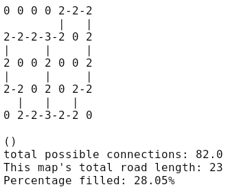
Terminal:
output.yaml:
tiles:
- [asphalt,       asphalt,       asphalt,       asphalt,       curve_right/N, straight/W,    curve_left/N]
- [curve_right/N, straight/W,    straight/W,    3way_right/E,  curve_left/E,  grass,         straight/N]
- [straight/N,    asphalt,       asphalt,       straight/N,    asphalt,       grass,         straight/N]
- [curve_right/W, curve_left/N,  asphalt,       straight/N,    asphalt,       curve_right/N, curve_left/E]
- [asphalt,       curve_right/W, straight/W,    3way_right/W,  straight/W,    curve_left/E,  asphalt]

objects:

- kind: sign_right_T_intersect
 pos: [4.05, 2.05]
 rotate: 180
 height: 0.18

- kind: sign_stop
 pos: [2.95, 2.05]
 rotate: 0
 height: 0.18

- kind: sign_stop
 pos: [4.05, 0.95]
 rotate: 180
 height: 0.18

- kind: sign_T_intersect
 pos: [4.15, 0.95]
 rotate: 270
 height: 0.18

- kind: sign_left_T_intersect
 pos: [2.95, 0.95]
 rotate: 0
 height: 0.18

- kind: sign_stop
 pos: [2.85, 0.95]
 rotate: 270
 height: 0.18

- kind: sign_right_T_intersect
 pos: [2.95, 3.95]
 rotate: 0
 height: 0.18

- kind: sign_stop
 pos: [4.05, 3.95]
 rotate: 180
 height: 0.18

- kind: sign_stop
 pos: [2.95, 5.05]
 rotate: 0
 height: 0.18

- kind: sign_left_T_intersect
 pos: [4.05, 5.05]
 rotate: 180
 height: 0.18

- kind: sign_left_T_intersect
 pos: [4.05, 5.05]
 rotate: 180
 height: 0.18

- kind: sign_stop
 pos: [4.15, 5.05]
 rotate: 90
 height: 0.18

- kind: truck
 pos: [2.31, 0.71]
 rotate: 264.61
 height: 0.2

- kind: building
 pos: [0.85, 0.47]
 rotate: 180
 height: 0.6

- kind: bus
 pos: [3.75, 2.61]
 rotate: 90
 height: 0.18

- kind: sign_pedestrian
 pos: [1.89, 2.67]
 rotate: 182.3
 height: 0.18

- kind: sign_do_not_enter
 pos: [6, 3]
 rotate: 90.0
 height: 0.18

- kind: sign_do_not_enter
 pos: [7.0, 3.0]
 rotate: 270.0
 height: 0.18

- kind: sign_yield
 pos: [1.69, 1]
 rotate: 0
 height: 0.18

- kind: sign_yield
 pos: [1.69, 2]
 rotate: 180
 height: 0.18

- kind: bus
 pos: [2.44, 1.75]
 rotate: 0
 height: 0.18
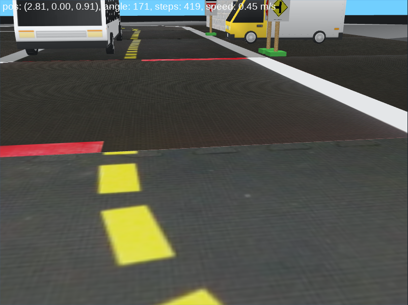
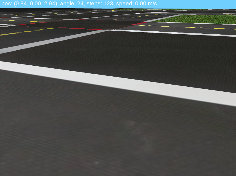
Simulator:
Ex. 2
./generatory.py --height 10 --width 10 --map-density "dense"
Outputs a dense map with dimensions 10x10 with no objects:
output.yaml
tiles:
- [asphalt,       asphalt,       asphalt,       asphalt,       asphalt,       asphalt,       asphalt,       asphalt,       asphalt,       asphalt,       asphalt,       asphalt]
- [asphalt,       curve_right/N, straight/W,    3way_right/E,  straight/W,    straight/W,    straight/W,    straight/W,    curve_left/N,  grass,         grass,         asphalt]
- [asphalt,       straight/N,    asphalt,       straight/N,    asphalt,       asphalt,       asphalt,       asphalt,       curve_right/W, curve_left/N,  grass,         asphalt]
- [asphalt,       3way_right/N,  straight/W,    4way,          straight/W,    straight/W,    curve_left/N,  asphalt,       asphalt,       straight/N,    grass,         asphalt]
- [asphalt,       straight/N,    asphalt,       straight/N,    grass,         grass,         straight/N,    asphalt,       asphalt,       curve_right/W, curve_left/N,  asphalt]
- [asphalt,       straight/N,    asphalt,       curve_right/W, curve_left/N,  grass,         curve_right/W, curve_left/N,  asphalt,       asphalt,       straight/N,    asphalt]
- [asphalt,       curve_right/W, curve_left/N,  grass,         curve_right/W, curve_left/N,  grass,         straight/N,    asphalt,       asphalt,       straight/N,    asphalt]
- [asphalt,       grass,         straight/N,    grass,         grass,         curve_right/W, straight/W,    curve_left/E,  asphalt,       asphalt,       straight/N,    asphalt]
- [asphalt,       grass,         curve_right/W, straight/W,    curve_left/N,  grass,         grass,         grass,         curve_right/N, straight/W,    curve_left/E,  asphalt]
- [asphalt,       grass,         grass,         grass,         curve_right/W, curve_left/N,  grass,         curve_right/N, curve_left/E,  grass,         grass,         asphalt]
- [asphalt,       grass,         grass,         grass,         grass,         curve_right/W, straight/W,    curve_left/E,  asphalt,       grass,         grass,         asphalt]
- [asphalt,       asphalt,       asphalt,       asphalt,       asphalt,       asphalt,       asphalt,       asphalt,       asphalt,       asphalt,       asphalt,       asphalt]
Simulator:
Ex. 3
./generator.py 5 5 --no-intersections --side-objects "sparse" --road-objects "sparse"
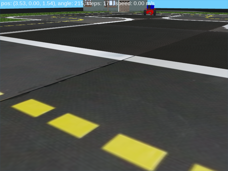
Outputs a 5x5 map with a border, and with no intersections and sparse object density, with none on the road:
output.yaml
tiles:
- [grass,         grass,         grass,         grass,         grass,         grass,         grass]
- [grass,         grass,         grass,         curve_right/N, straight/W,    curve_left/N,  grass]
- [grass,         grass,         curve_right/N, curve_left/E,  asphalt,       straight/N,    grass]
- [grass,         curve_right/N, curve_left/E,  asphalt,       asphalt,       straight/N,    grass]
- [grass,         straight/N,    asphalt,       curve_right/N, straight/W,    curve_left/E,  grass]
- [grass,         curve_right/W, straight/W,    curve_left/E,  grass,         grass,         grass]
- [grass,         grass,         grass,         grass,         grass,         grass,         grass]


objects:

- kind: house
  pos: [0.69, 6.22]
  rotate: 0
  height: 0.5

- kind: house
  pos: [3.0, 0.32]
  rotate: 270
  height: 0.5

- kind: sign_yield
  pos: [6.68, 0.95]
  rotate: 17.63
  height: 0.18

- kind: duckiebot
  pos: [2.18, 4.4]
  rotate: 16.69
  height: 0.1

- kind: tree
  pos: [4.17, 0.26]
  rotate: 86.16
  height: 0.25

- kind: duckie
  pos: [6.22, 4.9]
  rotate: 166.33
  height: 0.08

- kind: tree
  pos: [6.77, 3.89]
  rotate: 121.33
  height: 0.25

- kind: sign_t_light_ahead
  pos: [6.77, 3.15]
  rotate: 142.28
  height: 0.18

- kind: tree
  pos: [6.48, 4.11]
  rotate: 329.35
  height: 0.25
Simulator:
- The density parameter does not scale well with size. It is currently calibrated to a 10x10 map. Due to the nature of smaller maps, where variation in density is very limited, any map under 7x7 in dimensions simply ignores any density entered, for the time being.
This program is in beta, so if you run into any bugs, please open an issue
pathdfinder.py takes an adjacency matrix output by generator.py (adj_matrix.npz), a startpoint, and an endpoint, and outputs a path.yaml containing the path calculated. This path is determined by the algorithm that the user decides to implement. No algorithm is implemented by default.
- adj_matrix.npz is loaded into the program
- it is converted into an adjacency matrix where nodes are intersections, the startpoint, and the endpoint
- a path finding algorithm implemented by the user is applied
- by default a static placeholder path is present
- The a visual representation of the path chosen is output to path.yaml
This program can be run by entering the following in a terminal while in the map-utils directory:
./pathfinder.py <file> <start_x> <start_y> <end_x> <end_y>
All arguments are requred.
file: the file path to adj_matrix.npz output by generator.pystart_x: the x-coordinate of the startpoint for pathfinding. Together withstart_yit must refer to a tile that is part of the road network.start_y: the y-coordinate of the startpoint for pathfinding. Together withstart_xit must refer to a tile that is part of the road network.end_x: the x-coordinate of the endpoint for pathfinding. Together withend_yit must refer to a tile that is part of the road network.end_y: the y-coordinate of the endpoint for pathfinding. Together withend_xit must refer to a tile that is part of the road network.
./pathfinder.py adj_matrix.npz 2 2 5 6
path.yaml:
0 0 0 1 1 1 1 0
0 0 0 1 0 0 1 0
0 0 S 1 0 0 1 0
0 0 0 0 0 0 1 0
0 0 0 0 0 0 1 0
0 0 0 0 0 0 1 0
0 0 0 0 0 X 1 0
0 0 0 0 0 0 0 0
- S is the startpoint
- X is the endpoint
- 1 is used for traversed tiles
