Group Maps
Group Maps selects a subset of Map Warper maps from the NYC Space/Time Directory, and groups them in bands of a configurable amount of years.
From a Map Warper dataset file, Group Maps creates two GeoJSON files, one with all the maps, and one containing one Feature per group.
Group Maps uses Turf to do geospatial intersection and union operations.
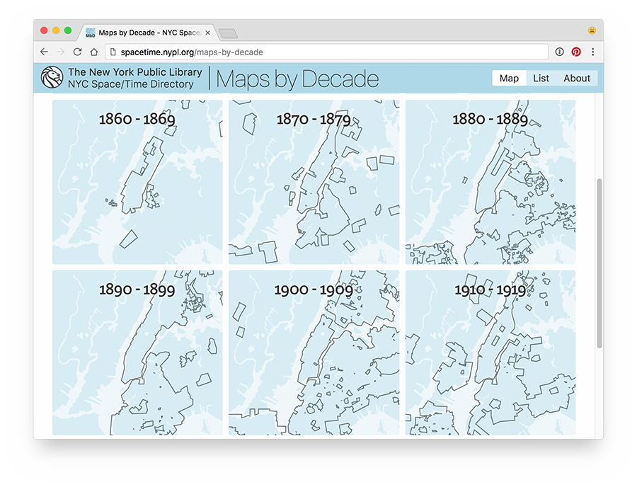
Example of Map Warper maps of New York City, grouped by decade:
Installation & Usage
-
Install Group Maps:
npm install nypl-spacetime/group-maps -
Download the Map Warper objects NDJSON file from the NYC Space/Time Directory's data repository:
wget http://s3.amazonaws.com/spacetime-nypl-org/datasets/mapwarper/mapwarper.objects.ndjson -
Create a configuration file, or use
maps-by-decade.config.js.
Group Maps exposes one function:
const groupMaps = require('spacetime-group-maps')
const geoJSONStreams = groupMaps(pathToNDJSON, config)- Input:
- path to NDJSON file containing Map Warper maps
- configuration object, see below
- Output:
- Object containing wwo Highland streams,
allandgrouped; containing GeoJSON data
- Object containing wwo Highland streams,
Example
const groupMaps = require('spacetime-group-maps')

const config = require('./maps-by-decade.config.js')
const pathToNDJSON = 'mapwarper.objects.ndjson'

const geoJSONStreams = groupMaps(pathToNDJSON, config)

geoJSONStreams.all.pipe(fs.createWriteStream('./maps-by-decade.all.geojson'))
geoJSONStreams.grouped.pipe(fs.createWriteStream('./maps-by-decade.grouped.geojson'))
See the Group Maps ETL module for a complete example on how to use Group Maps.
Configuration
module.exports = {
  groupBy: (object) => {
    // Group maps using the following value
    const getDate = (str) => new Date(`${str}`)
    const bandSize = 10
    const validSince = object.validSince
    const validUntil = object.validUntil
    const year = (getDate(validSince).getFullYear() + getDate(validUntil).getFullYear()) / 2
    return Math.floor(year / bandSize) * bandSize
  },

  properties: (object) => ({
    // Only copy the following properties to GeoJSON Features in output
    id: object.id,
    uuid: object.data.uuid,
    imageId: object.data.nyplDigitalId,
    name: object.name,
    year: object.validSince
  }),

  // Only use maps intersecting with this GeoJSON geometry
  geometry: {
    type: 'Polygon',
    coordinates: [
      [
        [
          -73.424377,
          40.436495
        ],
        [
          -73.424377,
          41.15591
        ],
        [
          -74.347229,
          41.15591
        ],
        [
          -74.347229,
          40.436495
        ],
        [
          -73.424377,
          40.436495
        ]
      ]
    ]
  },

  // Only use maps published in this year, or newer
  yearMin: 1850,

  // Only use maps published in this year, or older
  yearMax: 1949,

  // Only use maps depicting an area of this amount of square meters, or more
  minArea: 0

  // Only use maps depicting an area of this amount of square meters, or less
  maxArea: 5000000,

  // Buffer around grouped polygon, in meters
  buffer: 25,

  // Tolerance of simplification function; see http://mourner.github.io/simplify-js/
  simplifyTolerance: 0.00005
}