SafeMaps - PennAppsXXI Hackathon Project
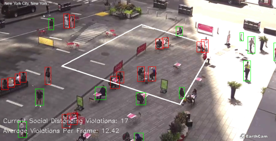
SafeMaps is a platform that allows for people to make conscious decisions before leaving their homes. Using cameras running a person detection algorithm, data can be collected on how well social distancing is being practiced in the area. These cameras would be installed in public places like large couryards, parks, and other open spaces. The data is then sent back to a database in real time and rendered as a heat map for the end user, allowing them to plan an evening out, morning jog, or commute to work before even leaving home.
Technology Used
OpenCV and pythong was used to process the video data. The front end for the website was created made with ReactJS. All of the data produced by the videos is stored on a postgres server and accessed via POST/GET requests served by a cherrypy server
Each camera has different angles and heights, a perspective approach was adopted here, where user will click on the footage for a Bird's Eyes View rectangle to eliminate the affect of camera tilt. Then select a distance approximate to 6 ft in order to help the algorithm to get the most accurate Eucldean Distance to account for different depth of fields for different cams.

The Eucldean distance is calculated with Scipy, Numpy for each pair of detected people and results rendered to each frame that is being analyzed.

Installation/Running
To launch the website, go to /web/ui and run the following:
npm i
npm start
Doing so will launch the website on http://localhost:8080
If you'd like to run your own instance of the postgres db to connect to, go to /web/server/ and copy conf.default.json into a file called conf.json After filling out the necessary fields run:
python3 postgres.py
python3 server.py
You will need a running postgres instance in order for this to work.