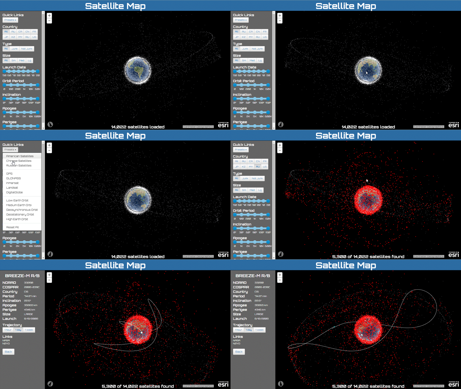
This application displays ALL known man-made satellites orbiting the Earth in a 3d viewer.
Click here to view the live application.
- ArcGIS API for JavaScript by Esri
- Esri’s JavaScript library for mapping and analysis.
- Bootstrap by Twitter Inc
- A useful and comprehensive UI framework. This application leveraged a subset of bootstrap pertaining to buttons and input elements.
- Bootstrap Slider by Kyle J. Kemp
- A bootstrap based slider.
- Google Fonts, specifically Orbitron and Oswald
- "A web with web fonts is more beautiful, readable, accessible and open."
- jQuery by jQuery Foundataion Inc
- A JavaScript framework for DOM manipulation and a foundation for many other frameworks.
- satellite-js by Shashwat Kandadai and UCSC
- Modular set of functions for SGP4 and SDP4 propagation of TLEs.
Satellite descriptions and ephemeris are sourced from Space-Tracker a site maintained by the Joint Functional Component Command for Space. The satellite-js JavaScript library is used to convert the downloaded TLE file into geographic locations.
Below, showing all 14,024 man-made satellites. Geostationary satellites are highlighted in red and the 24 hour trajectory is displayed for the ESA satellite GIOVE-B.
The following animation demonstrates the selection of all Russian satellites and the picking of discarded Briz-M rocket booster with the international designation of 2008-039C.

