Mapping_and_Path_Planning
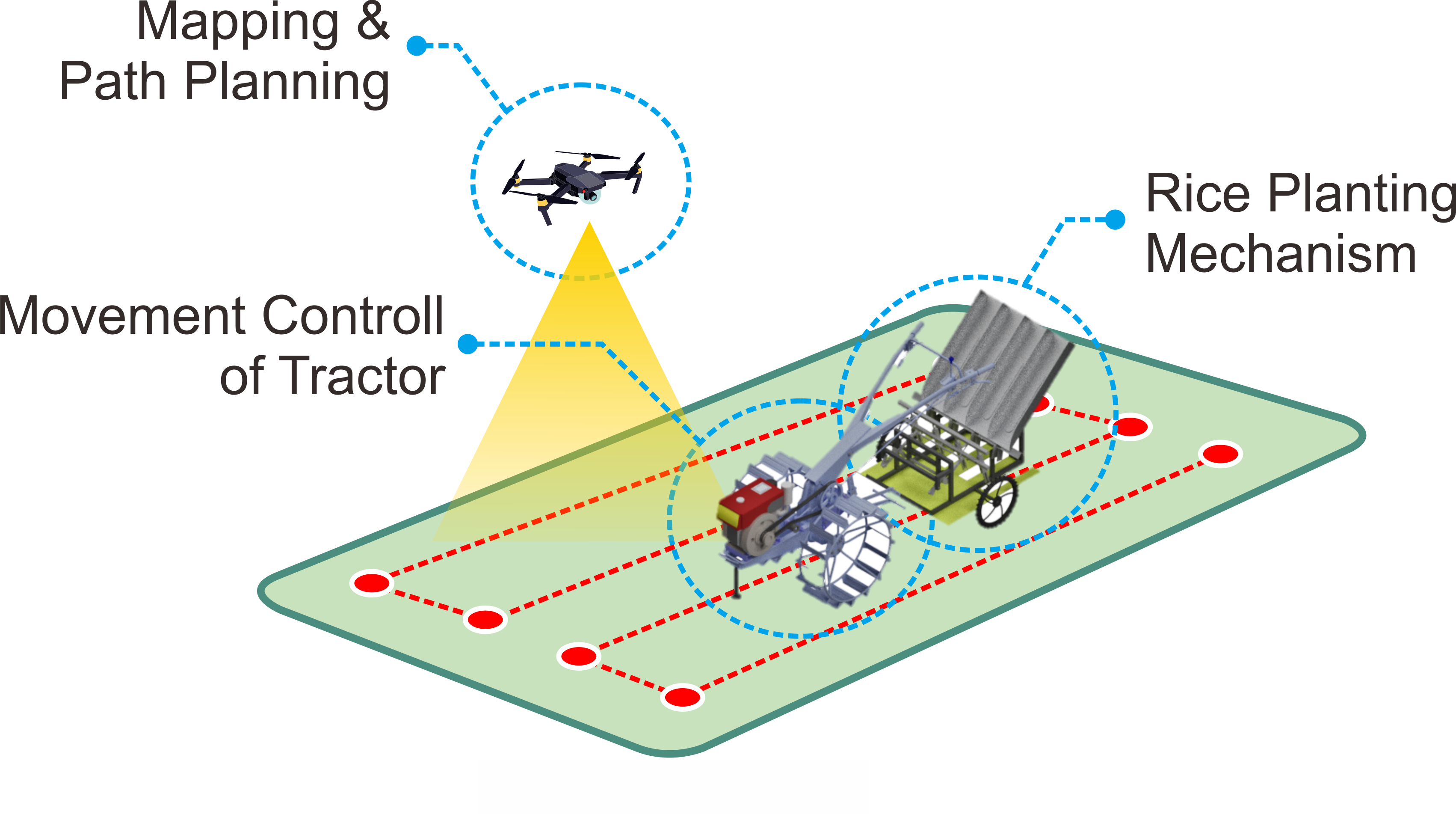
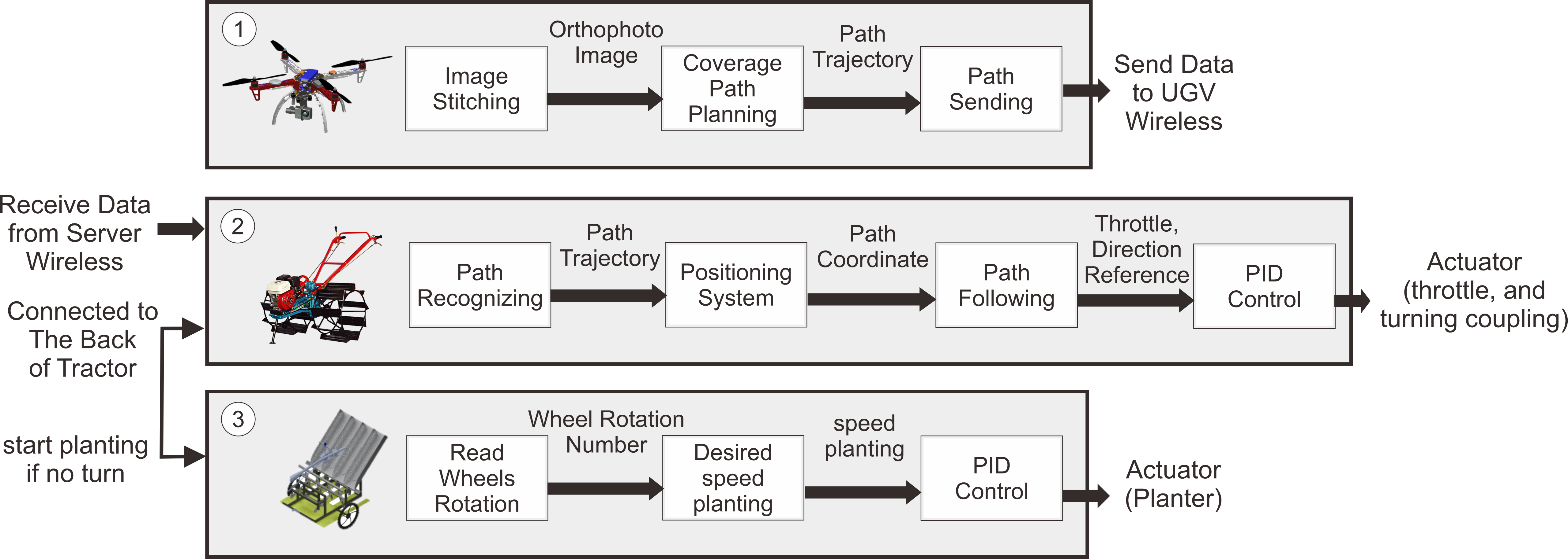
ROBOTANI : Planting Path Planning and Mapping System Software is a software system used to manage image and location data that have been obtained from aerial data collection on agricultural land. The output of this software is a high-resolution map image along with GPS-based location and planting path in the form of coordinates based on GPS location.
Software Requirements
Windows
Docker-Toolbox Oracle VM VirtualBox Kinematic Alpha OSGeo4W64 (GDAL) Git Bash Visual Studio Code
Linux
Docker Terminal Visual Studio Code
Operation
Run NodeODM
• Open “Docker Quickstart Terminal”, wait until IP of your PC displayed. • Note the machine IP • Run docker run -p 3000:3000 opendronemap/nodeodm • Wait until nodeODM started
Run Graphical User Interface
• Open “Administrator : Command Prompt” or “Terminal of Visual Studio Code” • Enter directory of code, e.g : “C:\Users\User_Name” by run cd C:\Users\User_Name • Open the software by run python ROBOTANI_GUI_v3.py • Wait until GUI displayed.
Read the software manual.

