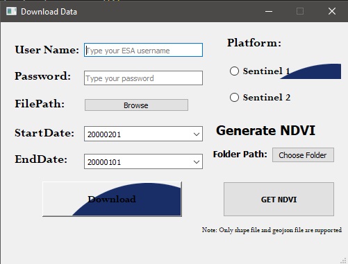
This application is developed to download the Sentinel 2 imagery as well as Sentinel 1 imagery according to the provided Shape file or GeoJson file. After the image is downloaded user can also generate the NDVI index of the same image.
Sentinelsat-Download data.py: Actual Code
GUI1.ui: UI file
demo_for_download.mp4: Demo video for downloading the Imagery.
demo_for_ndvi.mp4: Demo Video for Generating NDVI.
output: Contains demo output of the code.
esa_logo.jpg: Logo image used on the UI.
Install all the dependencies using
pip install -r req.txt- Enter the ESA Username and Password.
- Select the path of Shp file or Geojson File from FilePath option.
- Select the starting date and Ending date of remote sensed imagery.
- Select the source of the image by choosing the available platform i.e either Sentinel 1 or Sentinel 2.
- Click on Download Option to initiate the process.
- Extract the Downloaded image file from ZIP.
- Select the folder path.
- Click on GET NDVI button to initiate the process. Output image is displayed on the screen and also saved on the output folder.
