Please note: I am currently extremely busy and will not have time to work on this package before summer 2017. If you have requests or additions you would like me to add please make a pull request or add an issue and I will look at it as soon as I have time.
This is a package for making easy maps of Denmark.
Currently, the package allows you to do three things:
- make basic maps of Denmark
- turn these maps into (static) choropleth maps
- plot longitude-latitude points on a map of Denmark
I recommend you install the development version from github, using Hadley Wickham's devtools package:
if(!require("devtools")) install.packages("devtools")
devtools::install_github("sebastianbarfort/mapDK")
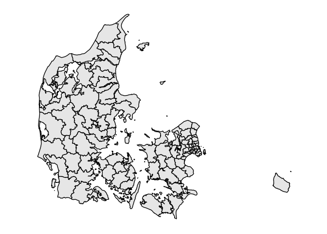
To create a basic map of Denmark at the municipality level simply run
library(mapDK)
mapDK()
You can control the level of the map by specifying the detail argument. Currenty, mapDK accepts the following arguments
municipality- plots Denmark's 98 municipalitiesregion- plots Denmark's 5 regionsrural- plots Denmark's 11 rural areaszip- plots Denmark's 598 zip code areaspolling- plots Denmark's 1385 polling places (as of 2015)parish- plots Denmark's 1931 parishes
mapDK also allows you to create static choropleth maps using either the package's build in datasets, or new datasets provided by the user.
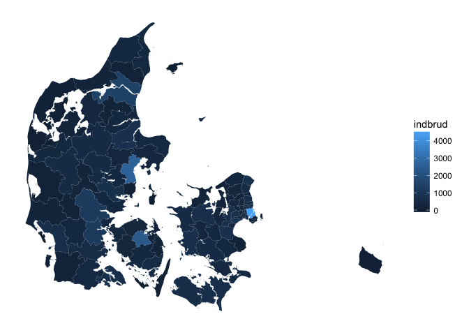
To create a static choropleth map at the municipality level we can use some data about burglaries in Denmark (included in the package).
One creates a choropleth map simply by specifying the values and id's (as strings) and the dataset in the call to mapDK
mapDK(values = "indbrud", id = "kommune", data = crime)If you don't provide names for all municipalities, the function will throw a warning.
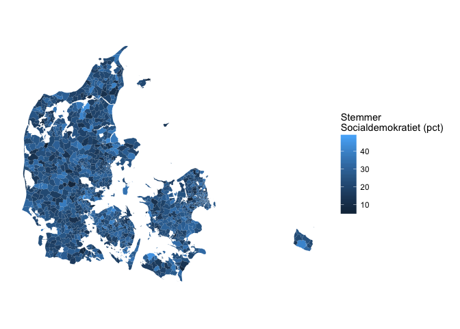
You can create cool maps of election results at the polling place level by specifying detail = "polling". The package includes a dataset of Danish general election 2011 results at the polling level. Below, we plot Socialdemokratiets election results in percent at each available polling place in the map dataset
mapDK(values = "stemmer", id = "id",
  data = subset(votes, navn == "socialdemokratiet"),
  detail = "polling", show_missing = FALSE,
  guide.label = "Stemmer \nSocialdemokratiet (pct)")
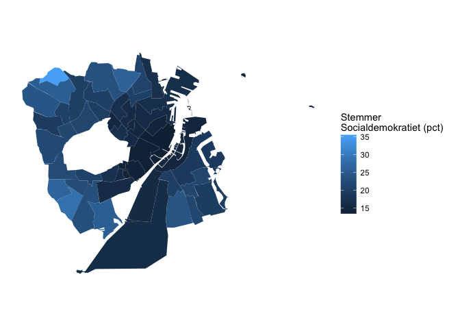
Say you only want to plot Socialdemokratiets votes in Copenhagen. That's easily done using the sub.plot option
mapDK(values = "stemmer", id = "id",
  data = subset(votes, navn == "socialdemokratiet"),
  detail = "polling", show_missing = FALSE,
  guide.label = "Stemmer \nSocialdemokratiet (pct)",
sub.plot = "koebenhavn")You can provide your own data set of longitude-latitude points (in WGS84) and plot them on a map of Denmark using the pointDK function. Below, I plot a data set of benches in Copenhagen available in the package
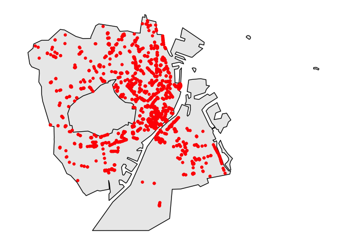
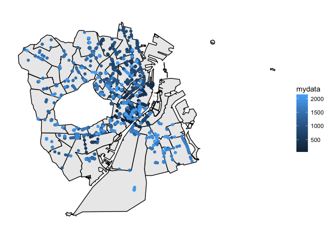
pointDK(benches, sub = "koebenhavn", point.colour = "red")You can also plot values in your data by specifying a values column
benches$mydata = 1:nrow(benches) # create values
pointDK(benches, values = "mydata", detail = "polling", sub.plot = "koebenhavn", point.colour = "red",
       aesthetic = "colour")
The getID function allows you to print the map key. Running this before plotting your dataset with mapDK is probably a good idea.
getID accepts only one argument, detail, and using it is as easy as (it returns keys for municipalities if nothing else is specified)
getID()[1:10]
#>  [1] "aabenraa"    "aalborg"     "aeroe"       "albertslund" "alleroed"
#>  [6] "aarhus"      "assens"      "ballerup"    "billund"     "bornholm"
Say you want the names of the parishes instead, just run mapDK(detail = "parish").
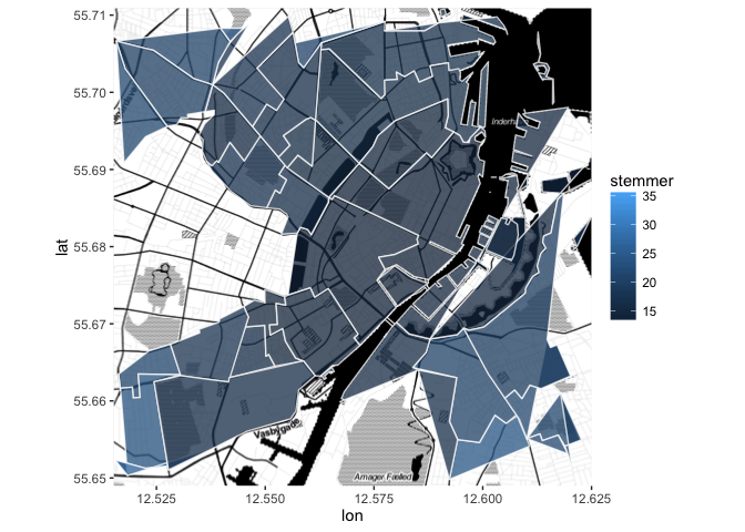
The functions in mapDK work nicely with ggmap. Below is an example
library("ggmap")
library("dplyr")
votes.cph.shape = mapDK::polling %>% filter(KommuneNav == "koebenhavn") %>% left_join(mapDK::votes)
cph.map = ggmap(get_map(location = c(12.57, 55.68),
                       source = "stamen",
                       maptype = "toner", crop = TRUE,
                       zoom = 13))
cph.map +
  geom_polygon(data = subset(votes.cph.shape, navn == "socialdemokratiet"),
                       aes(x = long, y = lat,
                           group = group, fill = stemmer),
alpha = .75) 