This repository contains config files for configuring map application in CKAN NG Frontend
NOTE If you are running CKAN Cloud you can ignore this section
- Install CKAN NG Frontend
- Enable carto plugin in your NG Frontend environment, along with your carto API credentials:
GIT_OWNER=starsinmypockets
CARTO_USER=test-user-123
Optionally you can provide a CARTO_APIKEY. By default carto's public_default key which can access all public resources will be used.
-
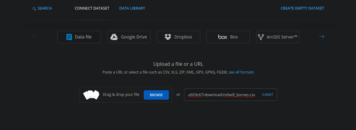
Add a data resource to carto In your carto dashboard, add a new Dataset:

-
Upload or add link to data resource
-
Check for geo-encoding Geo-encoding data is storeid in carto in the
the_geomcolumn. This column should be populated during data import.
Use carto's map builder to generate a map based on your data.
With your map completed, check out how to configure git (below) to display your map on your site.
Data needs to have a the_geom column with a valid geometry object.
See:
https://carto.com/developers/data-services-api/reference/#geocoding-functions
https://carto.com/help/working-with-data/carto-functions/
Or via SQL:
https://{USER_NAME}.carto.com/api/v2/sql?q=UPDATE {TABLE_NAME} SET the_geom = CDB_LatLng({LAT_COLUMN}, {LON_COLUMN})&api_key={API_KEY_WITH_WRITE_ACCESS}
https://paulwalker-datopian.carto.com/api/v2/sql?q=UPDATE accidents_2012_2017 SET the_geom = CDB_LatLng(loc_lat, loc_long)&api_key=Mef_QoqGyQRspq9AumGvbg
Auth: Note that the token used needs to be associated with an API user with write / update permissions
- Create a git repository called
maps - For each map on your site, add a directory to the repository with the name of your map -- this will be used in the path for frontend.
For example your repository directory could look like this:
./
../
.git/
README.md
accidents/
  config.json
property-value/
  config.json
311-calls-2018/
  config.json
Associated maps will be available at:
https://YOURSITE.com/maps/accidentshttps://YOURSITE.com/maps/property-valuehttps://YOURSITE.com/maps/311-calls-2018
- Add a
config.jsonfile to each map directory. If your map was exported as an iframe, the config should look like this:
Optionally you can add the following html files to your repository:
header.html -- will display above the map
{
  "type": "iframe",
  "url": "https://paulwalker-datopian.carto.com/builder/adb1a36d-85e0-488a-81dc-bf28530b876a/embed"
}You can have a go at this too, note that it is in Alpha and may not be stable.
{
  "type": "cartoVL",
  "map": {
    "container": "map",
    "style": "https://basemaps.cartocdn.com/gl/voyager-gl-style/style.json",
    "center": [-73.5673, 45.5017],
    "zoom": 12
  },
  "layers": [
    {
      "source": "accidents_2012_2017",
      "viz": "color: ramp(buckets(prop('nb_victimes_total'), [1, 1, 2, 3, 4, 5, 10, 100]), Prism)"
    }
  ]
}cartoVL
mapboxgl Map options object
Some optional attributes include:
- container the id of the div to load the map, should be
mapto use the default plugin template - style path to carto basemap style object
- center geographic center of map in
[LONG, LAT]format
"map": {
  "container": "map",
  "style": "https://basemaps.cartocdn.com/gl/voyager-gl-style/style.json",
  "center": [-73.5673, 45.5017],
  "zoom": 12
},
For more detailed options see the mapboxgl docs
An array of layer objects consisting of:
- source - the name of the carto resource
- viz a Viz definition based on carto expressions -- USE STRING SYNTAX NOT JAVASCRIPT SYNTAX
"layers": [
  {
    "source": "accidents_2012_2017",
    "viz": "color: ramp(buckets(prop('nb_victimes_total'), [1, 10, 100]), Prism)"
  }
]