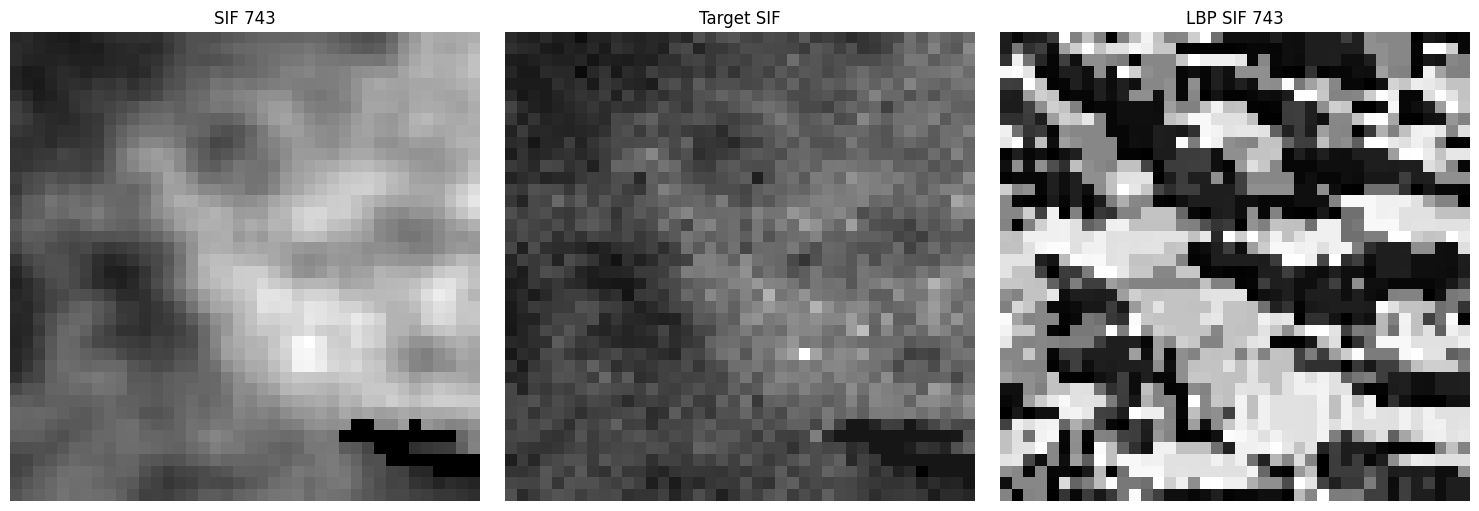
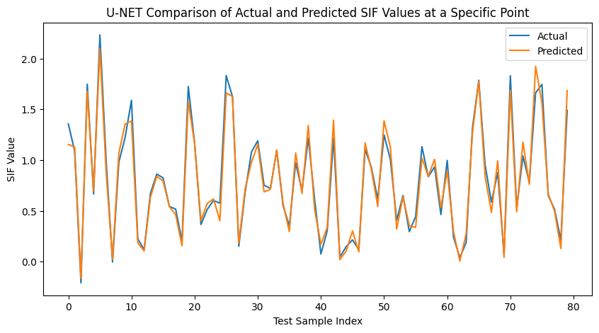
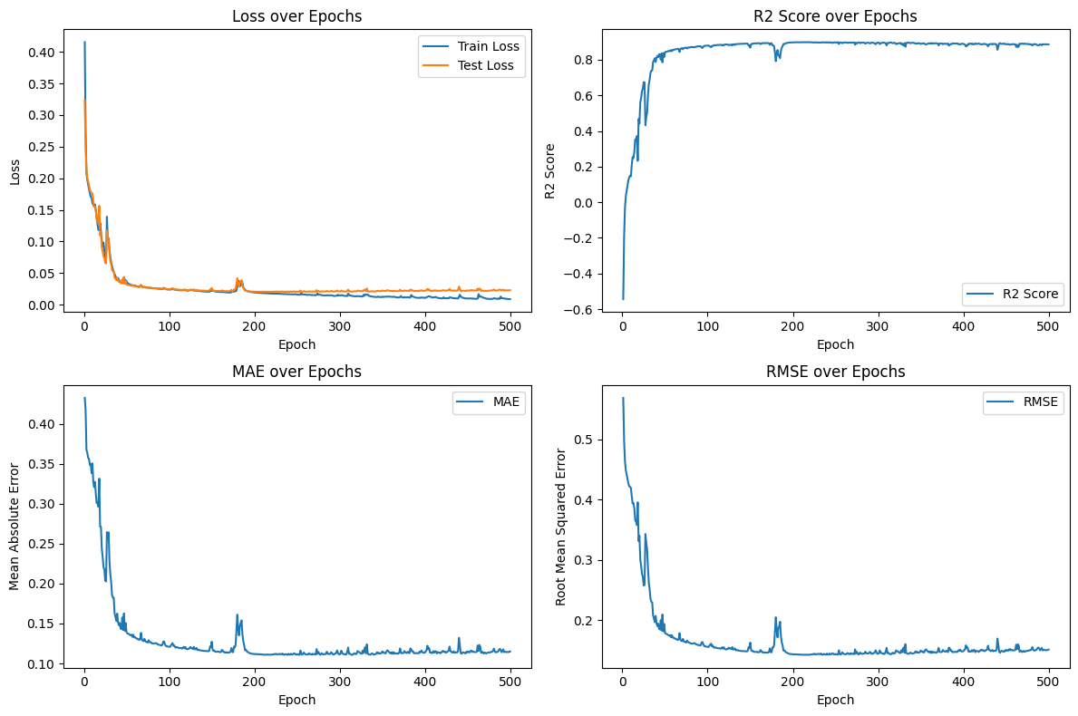
Geospatial data from satellites often comes with varying resolutions due to geographic, environmental, and climatic factors. This research focuses on downscaling lower-resolution TROPOMI-SIF data to higher resolution using MODIS auxiliary data. Local Binary Patterns (LBP) are applied to capture local spatial features, which are then processed using a U-Net model to predict higher-resolution samples.
- SIF_MODIS_CNN.ipynb - Implements spatial downscaling of SIF data using a Convolutional Neural Network (CNN) based on the methodology described in Gensheimer et al. (2022)..
- U-NET_SIF_MODIS.ipynb - Presents an enhanced approach for spatial downscaling by incorporating Local Binary Patterns (LBP) into a U-Net architecture, offering improved efficiency and accuracy.
Sentinel-5P's TROPOMI-SIF provides sun-induced fluorescence (SIF) data crucial for vegetation analysis. The data is aggregated at a resolution of 3.5x7 km for 2019. Download TROPOMI-SIF Data
MODIS provides vegetation indices at 1x1 km resolution on 16-day intervals for 2019. Download MODIS Data
Alternative sources for MODIS data are available based on product needs. For more information, visit MODIS Data.
- TROPOMI-SIF: Available in NETCDF4 format, specifically the SIF743 product.
- MODIS: Available in HDF format.
Convert these to CSV or other standard formats for further processing.
QGIS is used for data synthesis:
- SIF Data Synthesis: Import daily SIF data, aggregate to a coarse resolution, and match to a 1x1 km grid.
- MODIS Data Synthesis: Convert MODIS data to a 1x1 km grid.
- SIF-MODIS Integration: Integrate SIF and MODIS data grid-wise, aggregating over 16-day intervals.
Extract features by correlating SIF743 with MODIS indices and calculating the SIF difference. Apply Local Binary Patterns (LBP) to SIF743 to enhance texture information.
Preprocess the dataset, handle NaN values, and generate spatial matrices. Stack matrices for each feature and crop them to MxM size.
Apply LBP to SIF743 for localized texture extraction and pattern recognition.
Crop matrices to MxM size using random selection or sliding window techniques. Prepare the cropped matrices for input into the U-Net model.
Train a U-Net model with:
- 5 Encoder Blocks: Each block includes two convolutional layers with ReLU activation, with filters increasing from 16 to 256.
- Bottleneck: Uses 512 filters.
- 5 Decoder Blocks: Each includes upscaling, concatenation with feature maps from Encoder Blocks, and additional convolutional layers, with filters decreasing from 256 to 16.
- Final Layer: Outputs a single-channel prediction.
Adjust model parameters for optimal performance.
- Refer to
data_curation.ipynbfor steps on data extraction and curation. - Software: QGIS for data curation.
- Data Formats: TROPOMI_SIF (NETCDF), MODIS (HDF).
This project is licensed under the MIT License. See the LICENSE file for details.
Thanks to the creators of the Sentinel-5P TROPOMI and MODIS datasets, and the developers of the U-Net architecture.


