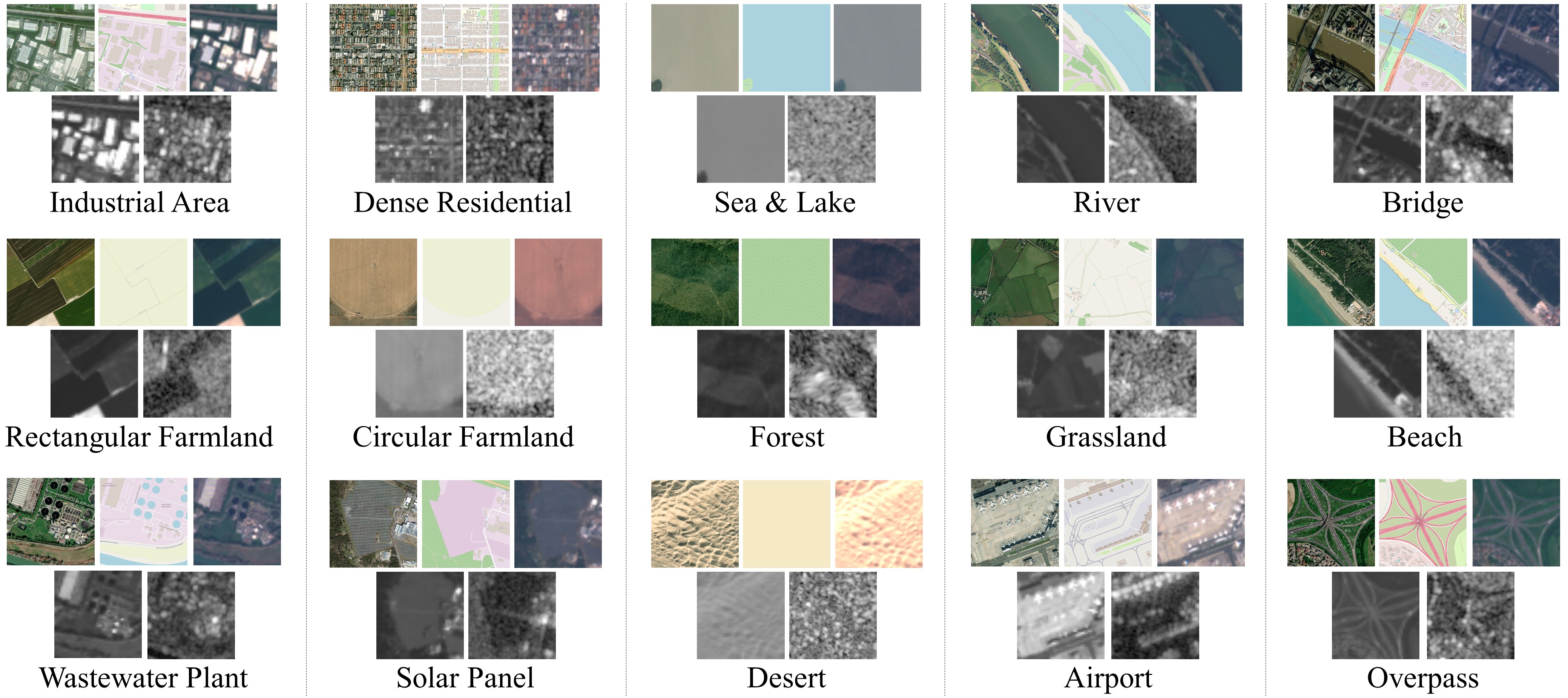
MSRSI is a Multi-Source Remote Sensing Image dataset. This dataset includes fifteen distinct land-cover categories and encompasses five different types of RS image sources. The land-cover categories include industrial area, dense residential, sea & lake, river, bridge, rectangular farmland, circular farmland, forest, grassland, beach, wastewater plant, solar panel, desert, airport, and overpass. The sources are VHR, SAR, MSI, MAP, and PAN images. The dataset consists of 150,000 images collected from these image sources. Each image source contains 30,000 images, while each land-cover category comprises 2,000 images.
The download link is MSRSI
MSRSI is first released in this paper, if you find it helpful in your research, please cite our paper.
@ARTICLE{sun10285469,
  title={Consistency Center-Based Deep Cross-Modal Hashing for Multi-Source Remote Sensing Image Retrieval},
  author={Yuxi Sun, Yunming Ye, Jian Kang, Ruben Fernandez-Beltran, Xutao Li, Zhenyu Xiong, Xu Huang, and Antonio Plaza},
  journal={IEEE Transactions on Geoscience and Remote Sensing},
  year={2023},
  doi={10.1109/TGRS.2023.3323495}
}
