Semantic segmentation of remote sensing images.
- Operation system: Ubuntu 16.04.3 LTS
- CUDA version: 8.0
- Programming language: Python 2.7
Modules:
tensorflow-gpu==1.4.1, scikit-image==0.13.0, tifffile==0.13.5,
pandas==0.20.3, keras==1.2.2, h5py==2.7.0, tqdm== 4.19.4
- Reference: kaggle-dstl 3rd blog
- Framework:
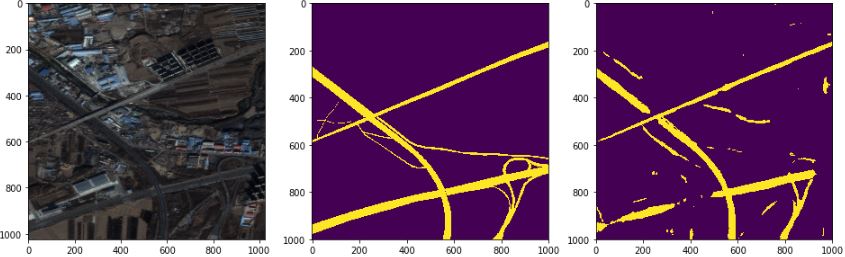
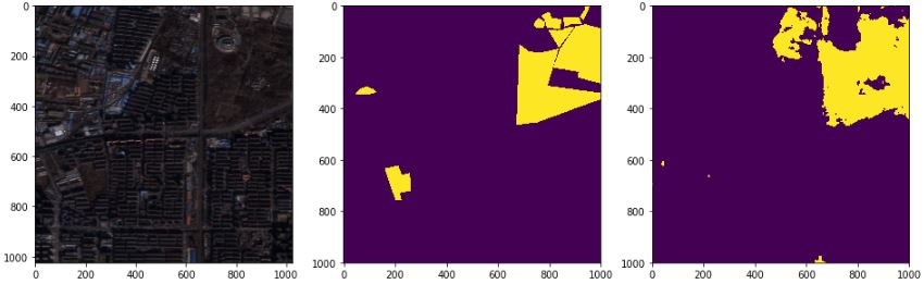
- Input and output: 1024*1024*3 (in), 1000*1000*1 (out), row*column*channel

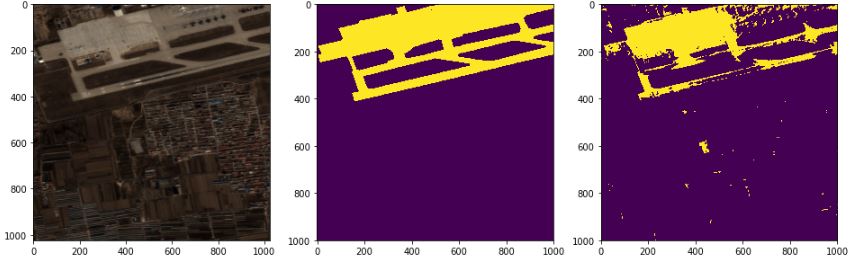
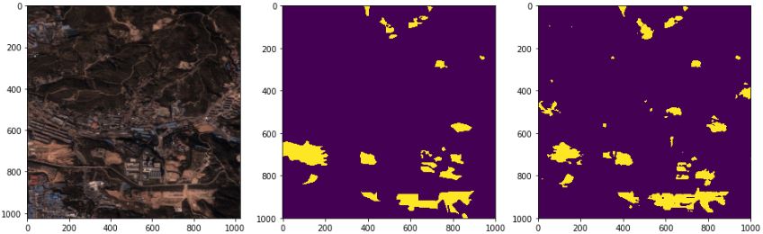
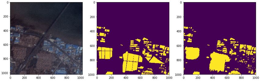
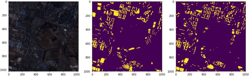
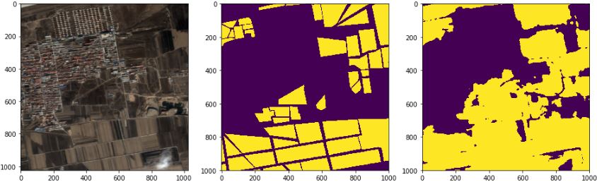
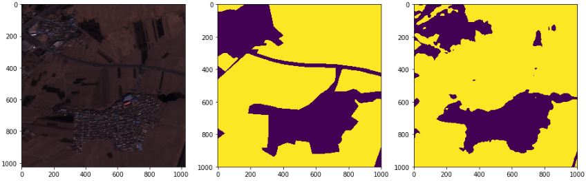
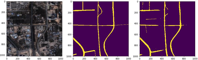
left: image, middle: ground truth(label), right: prediction
- Airport
- Baresoil
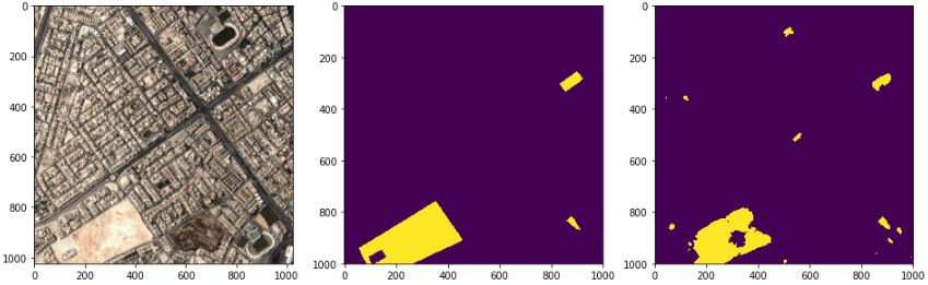
- Building
- Farmland
- Road
- Vegetation
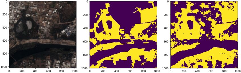
- Water