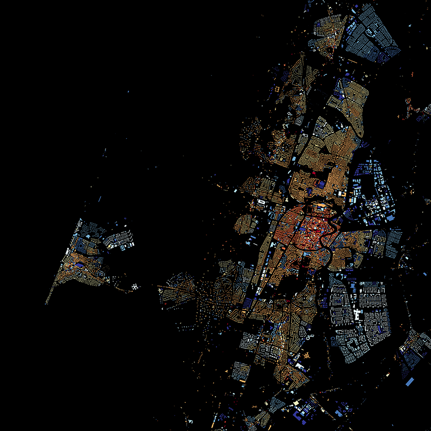
View map on http://code.waag.org/buildings.
Map showing all 9,866,539 buildings in the Netherlands, shaded according to year of construction. Data from BAG, via CitySDK. Map made with TileMill by Bert Spaan, Waag Society, inspired by BKLYNR.
MIT
This work is licensed under a Creative Commons Attribution-NonCommercial-ShareAlike 4.0 International License.

The map is made with open data and open source software only. This section of the README explains how to get the data, create the map and export high-res PNG and PDF files.
Install PostgreSQL and PostGIS, download data from NLExtract and import into database bag. Details can be found in NLExtract's documentation.
To create a map with buildings by year of construction (or area and function), execute the following SQL:
-- Aggregate mode function, to compute modal area and function
-- From: http://wiki.postgresql.org/wiki/Aggregate_Mode
CREATE OR REPLACE FUNCTION _final_mode(anyarray)
  RETURNS anyelement AS
$BODY$
    SELECT a
    FROM unnest($1) a
    GROUP BY 1
    ORDER BY COUNT(1) DESC, 1
    LIMIT 1;
$BODY$
LANGUAGE 'sql' IMMUTABLE;

CREATE AGGREGATE mode(anyelement) (
  SFUNC=array_append, --Function to call for each row. Just builds the array
  STYPE=anyarray,
  FINALFUNC=_final_mode, --Function to call after everything has been added to array
  INITCOND='{}' --Initialize an empty array when starting
);

CREATE SCHEMA tilemill;

CREATE TABLE tilemill.buildings AS
SELECT
  p.identificatie::bigint, bouwjaar::int,
  ST_Transform(p.geovlak, 4326) AS geom,
  round(mode(oppervlakteverblijfsobject)) AS oppervlakte,
  mode(vg.gebruiksdoelverblijfsobject::text) AS gebruiksdoel
FROM verblijfsobjectactueelbestaand v
JOIN verblijfsobjectpandactueel vp
  ON vp.identificatie = v.identificatie
JOIN pandactueelbestaand p
  ON vp.gerelateerdpand = p.identificatie
JOIN verblijfsobjectgebruiksdoelactueel vg
  ON v.identificatie = vg.identificatie
GROUP BY
  p.identificatie, bouwjaar, p.geovlak;

CREATE INDEX buildings_geom_idx
  ON tilemill.buildings
USING gist (geom);Install TileMill, copy the contents of the tilemill to your local TileMill projects directory (usually ~/Documents/MapBox/project), or create a symbolic link. The TileMill project file connects with PostgreSQL using user postgres and password postgres. Edit project.mml to change user and password.
A script to export high-res images is available in the sections directory of this repository.