scikit-map is a Python module to produce maps using machine learning, reference samples and raster data. It is fully compatible with scikit-learn and distributed under the MIT license.
The project was started in 2020 by GeoHarmonizer and originally called eumap. In 2023, eumap was archived and the codebase moved to this repository.
scikit-map implements:
- Parallel raster reading and writing
- Spatial and time-series gapfilling
- Space and spacetime overlay
- ML training, evaluation and spatial prediction
- Parallel tilling processing
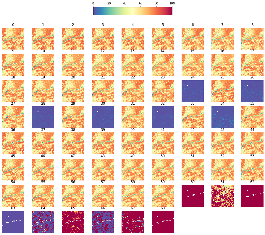
Example of NDVI quarterly time-series processing:
from skmap.data import toy
from skmap.io import process

# Loading NDVI quarterly time-series with gaps
toy.ndvi_rdata(gappy=True
    # Gapfilling time-series by seasonal convolution
    ).run(process.SeasConvFill(season_size=4), drop_input=True
    # Smoothing time-series by Whittaker
    ).run(process.WhittakerSmooth(), group='ndvi.seasconv', drop_input=True
    # Setting smoothed time-series as main input
    ).rename(groups={'ndvi.seasconv.whittaker': 'ndvi'}
    # Running yearly aggregation by std. and percentile 50th
    ).run(process.TimeAggregate(time=[process.TimeEnum.YEARLY], operations = ['p50', 'std']), group=['ndvi']
    # Running trend analysis using per-pixel linear regression
    ).run(process.TrendAnalysis(season_size=4), group='ndvi'
    # Ploting all raster data
    ).plot(v_minmax=[0,100])
Output in verbose mode:
[20:57:02] RasterData with 24 rasters and 1 groups
[20:57:02] Reading 24 raster file(s) using 4 workers
[20:57:07] Read array shape: (256, 256, 24)
[20:57:07] Running SeasConvFill on (256, 256, 24) for ndvi group
[20:57:07] Dropping data and info for ndvi group
[20:57:07] Execution time for SeasConvFill: 0.15 segs
[20:57:07] Running WhittakerSmooth on (256, 256, 24) for ndvi.seasconv group
[20:57:15] Dropping data and info for ndvi.seasconv group
[20:57:15] Execution time for WhittakerSmooth: 8.07 segs
[20:57:15] Running TimeAggregate on (256, 256, 24) for ndvi group
[20:57:15] Execution time for TimeAggregate: 0.12 segs
[20:57:15] Running TrendAnalysis on (256, 256, 24) for ndvi group
[20:57:24] Execution time for TrendAnalysis: 8.69 segs
Dependencies
scikit-map requires:
- Python (>= 3.7)
- Scikit-learn(>= 1.0)
- NumPy (>= 1.19)
- Rasterio (>= 1.1)
- Pandas (>= 2.0)
- Geopandas (>= 0.13)
- joblib (>= 1.1.1)
If you already have a working installation of gdal, scikit-learn and numpy, you can install scikit-map is using pip:
pip install -e 'git+https://github.com/openlandmap/scikit-map#egg=scikit-map[full]'© Contributors, 2023. Licensed under an MIT License.
To learn more about making a contribution to scikit-learn, please see our Contributing guide.
This work is supported by OpenGeoHub Foundation and MultiOne and has received funding from European Comission (EC) through the projects:
- AI4SoilHealth: Accelerating collection and use of soil health information using AI technology to support the Soil Deal for Europe and EU Soil Observatory (1 Jan. 2023 – 31 Dec. 2026 - 101086179)
- Open-Earth-Monitor Cyberinfrastructure: Environmental information to support EU’s Green Deal (1 Jun. 2022 – 31 May 2026 - 101059548)
- Geo-harmonizer: EU-wide automated mapping system for harmonization of Open Data based on FOSS4G and Machine Learning (Sep. 2019 – Jul. 2022 -CEF-TC-2018-5)


