This repo hosts South Korea administrative division geodata in open formats that can be used to build static and interactive maps (e.g. with D3), and was inspired by swiss-maps.
To see maps for Seoul, go to https://github.com/southkorea/seoul-maps
The following formats are available:
shp,
kml/kmz,
svg,
GeoJSON,
TopoJSON,
and RData.
Data is acquired from the following sources:
- KOSTAT: Administrative division geodata for Census (센서스용 행정구역경계), 2011|2012}2013
- GADM: Global administrative areas
- POPONG: Hand-traced (for production)
- Wikimedia: Administrative divisions map of South Korea
South Korean administrative divisions are consisted of three levels:
- Provinces (시도): Special City(특별시), Metropolitan City(광역시), Province(도), Special Self-governing Province(특별자치도), Special Self-governing City(특별자치시)
- Municipalities (시군구): Si (시, city), Gun (군, county), Gu (구, district)
- Submunicipalities (읍면동): Eup (읍, town), Myeon (면, township), Dong (동, neighborhood), Ri (리, village)
- Precinct (선거구): TBA
The following data are available.
Numbers are data sizes in Megabytes in the following order: Country border, Provinces, Municipalities, Submunicipalities.
Numbers in parentheses are simplified versions of each format.
| Format \ Source | KOSTAT (2013) | GADM | POPONG | Wikimedia |
|---|---|---|---|---|
| ESRI Shapefile | 0, 9.6, 19, 46 | 5.5, 5.5, 5.8, 0 | 0 | 0 |
| KML/KMZ | 0, 0.16, 0.452, 2.8 | 1.5, 1.5, 1.7, 0 | 0 | 0 |
| SVG | 0 | 0 | 0, 0.014, 0, 0 | 0, 0, 0.100, 0 |
| GeoJSON | 0, 31, 52, 0 (0, 0.148, 0.364, 1.7) |
15, 15, 16, 0 | 0 | 0 |
| TopoJSON | 0, 1.2, 2.0, 4.9 (0, 0.032, 0.0.96, 0.812) |
1.5, 1.5, 1.6, 0 | 0 | 0 |
| RData | 0 | 1.0, 1.0, 1.2, 0 | 0 | 0 |
brew install gdal
npm install -g topojson
-
-
Projection files are provided here. Otherwise, copy the snippet below and save to a separate
prjfile having the same name as theshpfile.PROJCS["Bessel_1841_Transverse_Mercator",GEOGCS["GCS_Bessel_1841",DATUM["D_Bessel_1841",SPHEROID["Bessel_1841",6377397.155,299.1528128]],PRIMEM["Greenwich",0.0],UNIT["Degree",0.0174532925199433]],PROJECTION["Transverse_Mercator"],PARAMETER["False_Easting",200000.0],PARAMETER["False_Northing",500000.0],PARAMETER["Central_Meridian",127.0028902777778],PARAMETER["Scale_Factor",1.0],PARAMETER["Latitude_Of_Origin",38.0],UNIT["Meter",1.0]]- CRS: Korean 1985 / Modified Central, EPSG:5174
- Data encoding: EUC-KR
-
Downloaded dates
- 2011 version: Downloaded on Mar 2013.
- 2012 version: Downloaded on Feb 2015.
- 2013 version: Downloaded on May 2015.
-
-
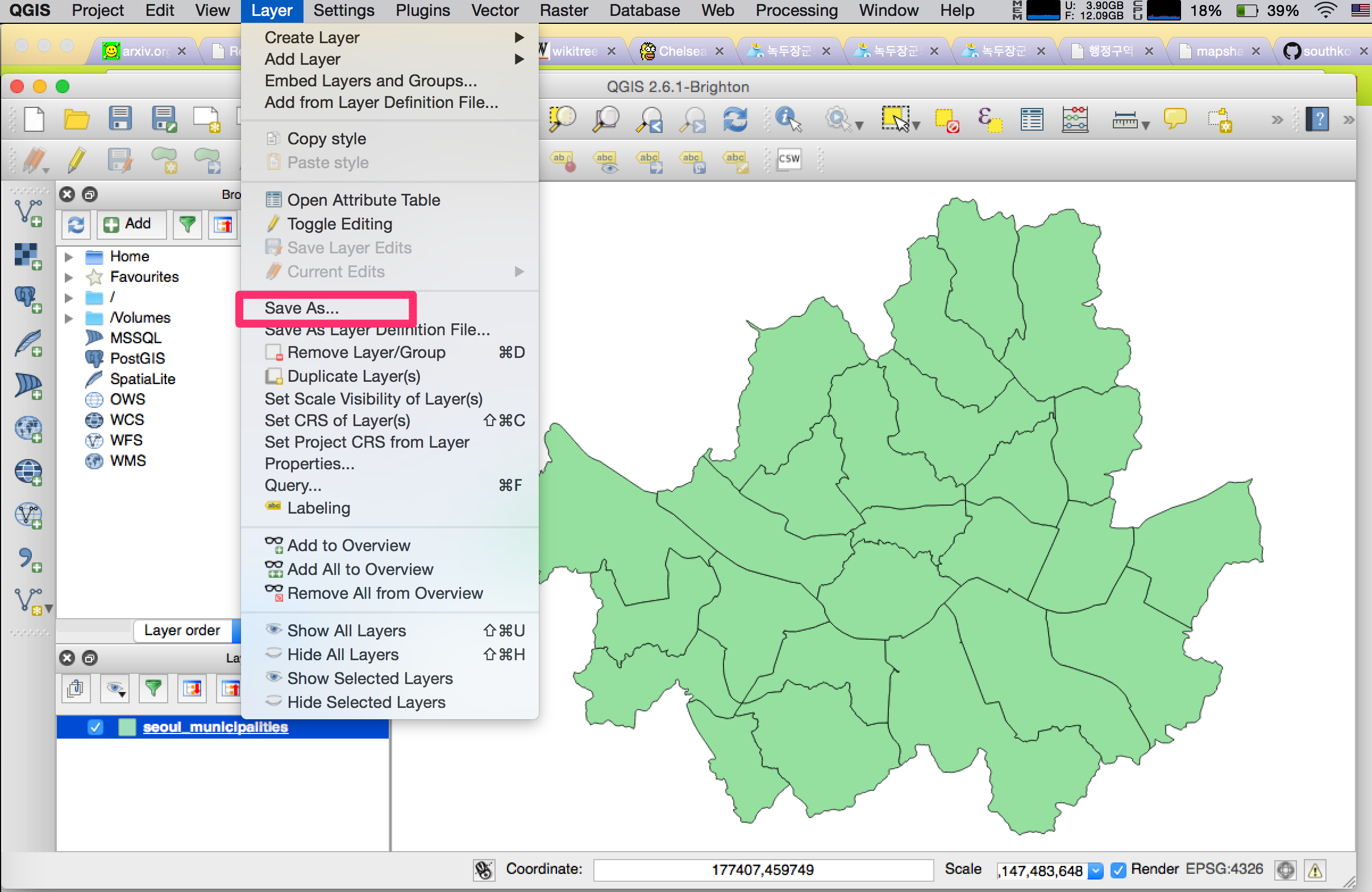
Download and install QGIS. With QGIS for each shapefile:
-
Change layer encoding to EUC-KR
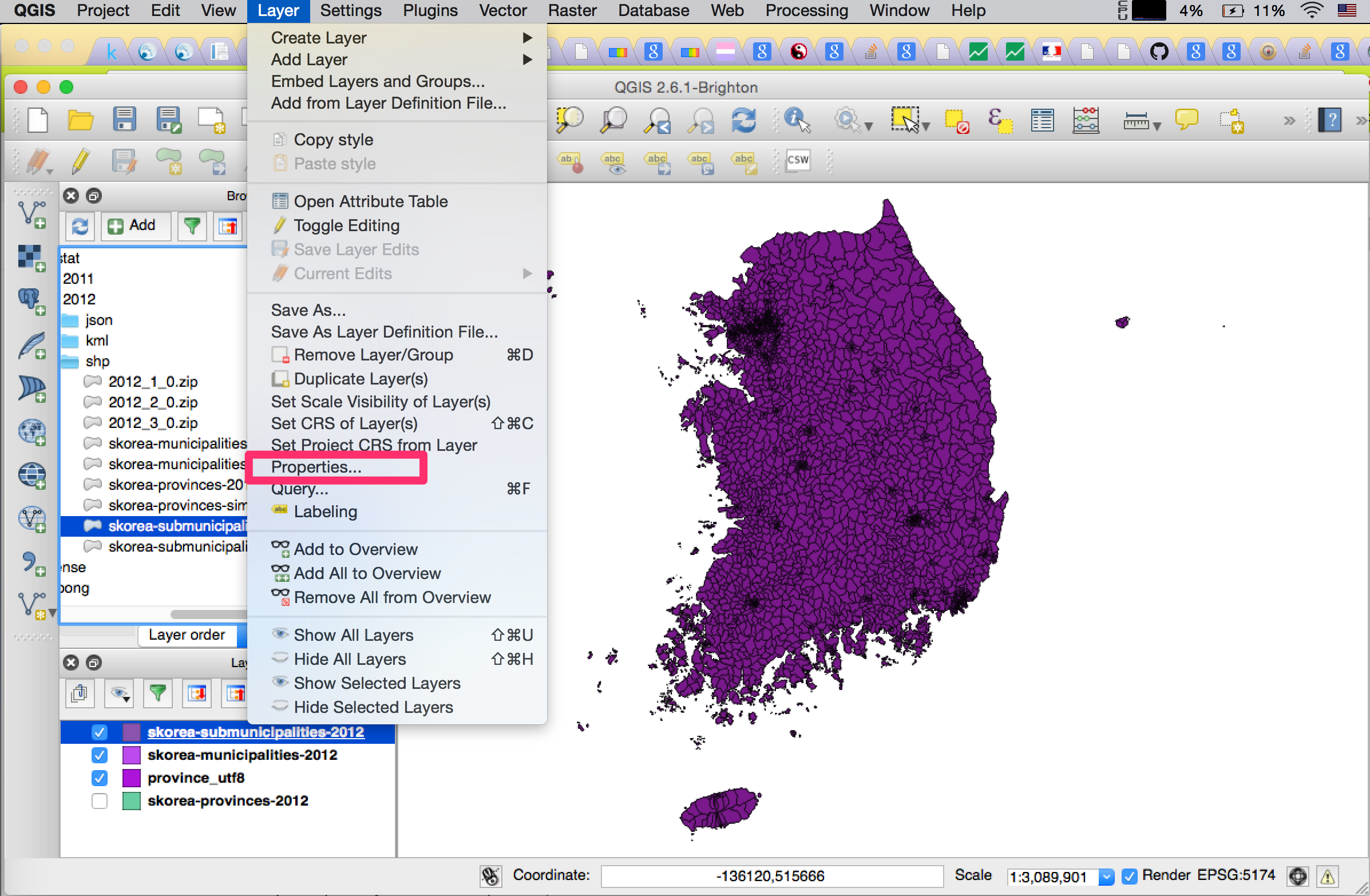
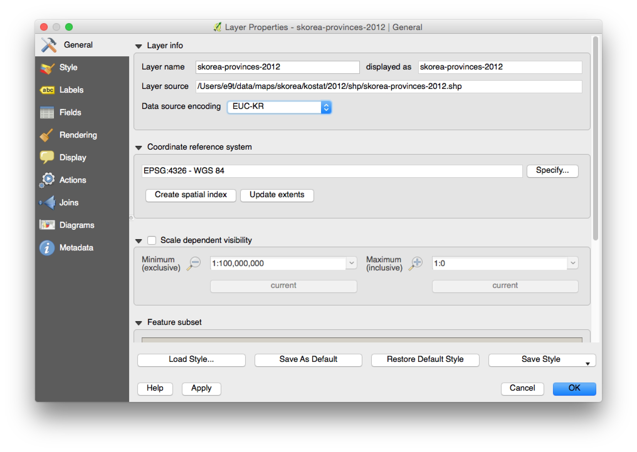
-
Save as, with CRS and data encoding as shown in the image below.
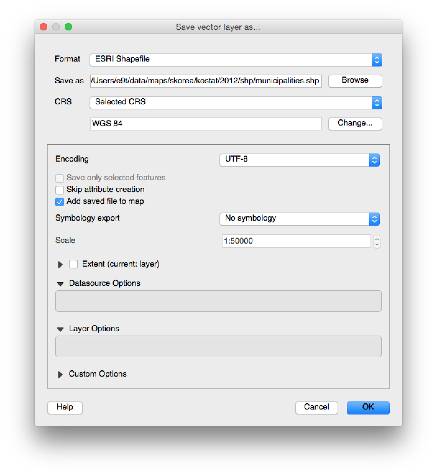
- Change CRS from Korean 1985 / Modified Central, EPSG:5174 to WGS84, EPSG:4326
- Change data encoding from System to UTF8
-
-
Convert
shpto GeoJSON, TopoJSONogr2ogr -f geojson [geojson_file] [shp_file] topojson -p -o [topojson_file] [geojson_file] -
Simplify
GeoJSONs with http://mapshaper.org/ (with Visvalingam / weighted area, 1% simplification) -
Convert simplifies
GeoJSONs toKMLogr2ogr -f kml [simplified_geojson_file] [kml_file]


To download data files, run:
make get_gadm
Created from shapefiles with ogr2ogr -f geojson [filename]-geo.json [filename].shp.
Created from GeoJSON files with topojson [filename]-geo.json -o [filename]-topo.json --properties.
To download file, run:
wget http://upload.wikimedia.org/wikipedia/commons/7/77/Administrative_divisions_map_of_South_Korea.svg
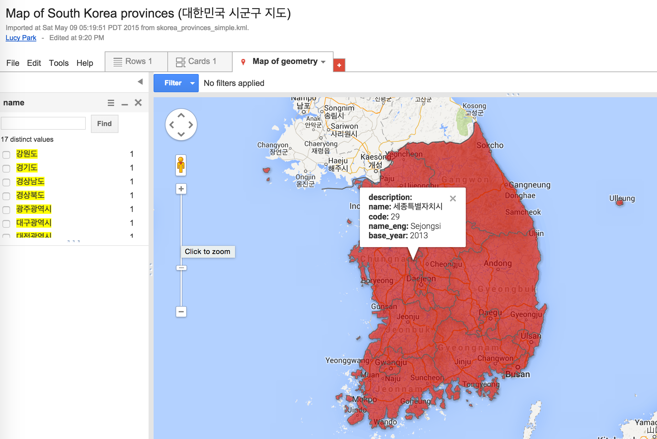
- 대한민국 시군구 지도 (KOSTAT KML, 2013)
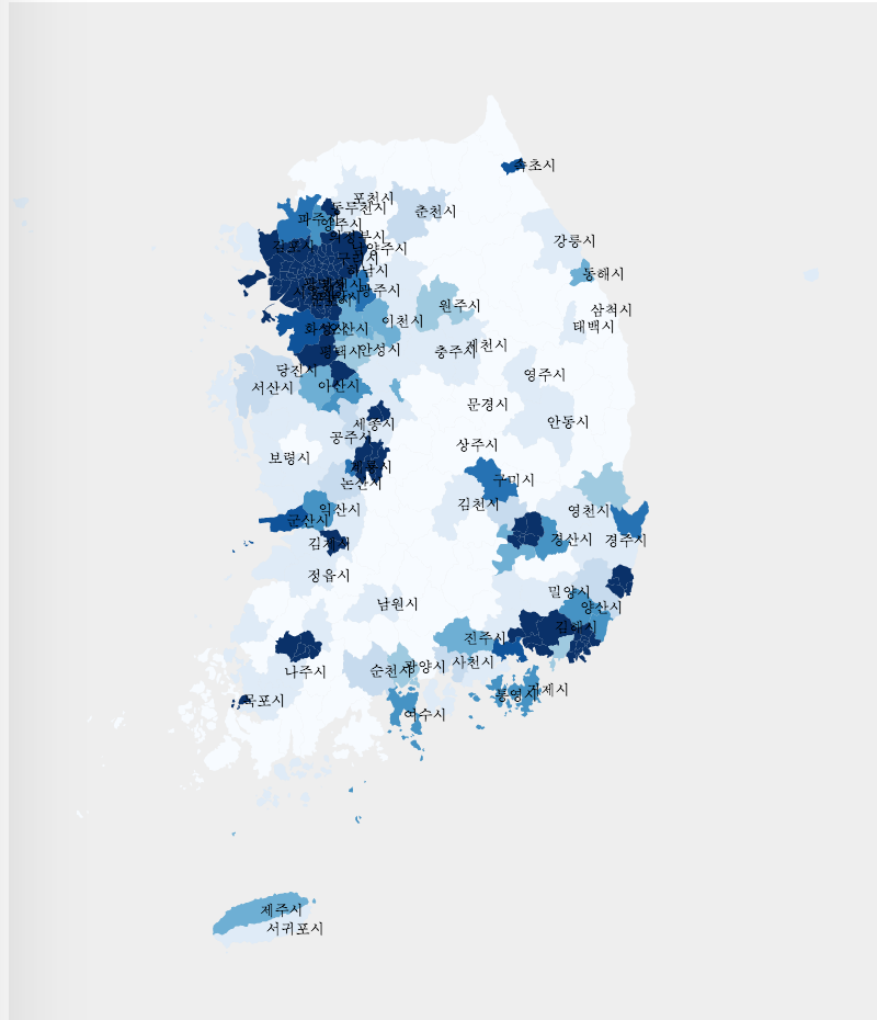
- 우리나라 시군구별 인구밀도 시각화 (KOSTAT TopoJSON, 2012)
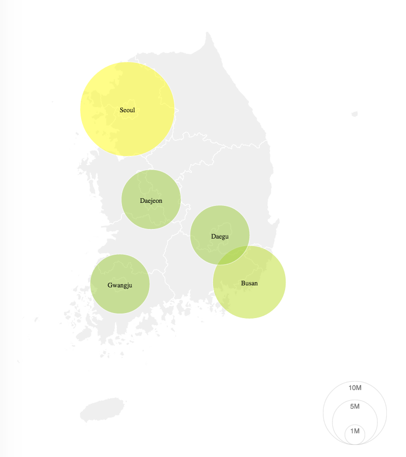
- 우리나라 도시별 인구수 시각화 (KOSTAT TopoJSON, 2012)
- 시도 시각화 (POPONG SVG)
- 시도 시각화 (GADM TopoJSON)
- 시군구 시각화 (GADM TopoJSON)
- ...add yours to this list!


- Lucy Park (Team POPONG)
- Justin Meyers
- KOSTAT: Free to share or remix.
- GADM: For non-commercial purposes only. Redistribution not allowed.
- POPONG:
- Wikimedia: GNU 1.2+
