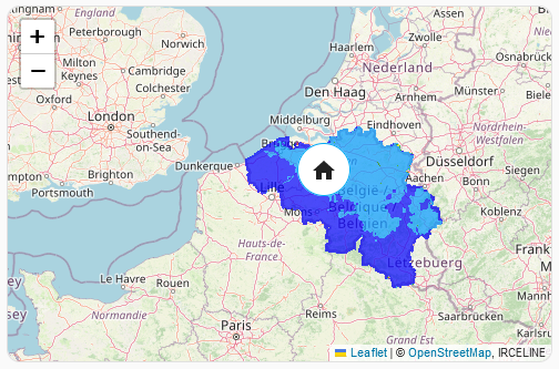
Take a look at the blog post introducing the custom:map-card for Home Assistant.
This is still very early alpha quality.
- Copy
map-card.jsto your/var/lib/hass/wwwfolder. - Click on
Edit Dashboard,Manage resourcesadd/local/map-card.jsasJavaScript Module.
The PR to add this to the default HACS repo is still open: hacs/default#2377
Follow the instructions to add a HACS Custom Repository.
Home Assistant contains a native map feature, if you don't need advanced features like WMS layers it might be a better choice.
type: custom:map-card
x: 51.23
y: 3.652Take a look at: https://nathan.gs/2024/01/06/ha-map-card-a-new-and-alternative-leaflet-based-map/#a-more-advanced-example-measuring-pm25-air-quality-for-my-home
| name | Default | note |
|---|---|---|
x |
Longitude | |
y |
Latitude | |
history_start |
Examples: 2022-03-01T12:00:00Z, 5 hours ago |
|
history_end |
now |
Examples: 2022-03-01T18:00:00Z, 2 hours ago, now |
focus_entity |
Entity to focus on (instead of X & Y) | |
map_height |
Set a fixed minium height for the map in pixels | |
title |
If empty, don't show a title | |
zoom |
12 | The zoom level |
card_size |
5 | The Home Assistant card size |
entities |
[] | Array of entities, will be listed as markers |
wms |
[] | WMS Layers, an array of WMS see below |
tile_layers |
[] | Tile Layers, an array of Tile Layers see below |
tile_layer_url |
https://tile.openstreetmap.org/{z}/{x}/{y}.png | Override the default map source |
tile_layer_attribution |
© <a href="http://www.openstreetmap.org/copyright">OpenStreetMap</a> | Set the correct map attribution |
tile_layer_options |
{} | The options for the default TileLayer |
history_date_selection |
false | Will link with a energy-date-selection on the page to provide a user controllable date range selector |
If x & y or focus_entity is not set it will take the lat/long from the first entity.
If using history_date_selection:true, please ensure a component with the template type: energy-date-selection has been added to the page. If this is set top level history_start/history_end configuration is ignored in favour of the selected date ranges. history_start will continue to override the selected date range and global settings.
Either the name of the entity or:
| name | Default | note |
|---|---|---|
entity |
The entity id | |
display |
marker |
icon, state or marker. marker will display the picture if available |
picture |
Set a custom picture to use on the marker. | |
size |
48 | Size of the icon |
color |
Random Color | Can defined as red, rgb(255,0,0), rgba(255,0,0,0.1), #ff0000, var(--red-color) |
history_start |
inherits | Will inherit from map config if not set. |
history_end |
inherits | Will inherit from map config if not set. |
history_line_color |
Random Color | Can defined as red, rgb(255,0,0), rgba(255,0,0,0.1), #ff0000, var(--red-color) |
history_show_lines |
true | Show the path |
history_show_dots |
true | Show little dots on the path |
css |
text-align: center; font-size: 60%; |
CSS for the marker (only for state and marker) |
fixed_x |
Display a fixed marker, this will ignore the latitude/longitude attributes | |
fixed_y |
Display a fixed marker, this will ignore the latitude/longitude attributes | |
fallback_x |
If the latitude/longitude is missing, use these fixed attributes | |
fallback_y |
If the latitude/longitude is missing, use these fixed attributes |
If history_start & history_end are set the card will display a line with all the previous locations (a track) for a particular entity.
| name | note |
|---|---|
url |
The url of the layer |
options |
The leaflet layer WMS options or Tile Layer options |
The leaflet-extras has a nice list of available tile layer providers.
- home-assistant community: map-card: a slightly improved map-card, this topic should be used for general discussions.
- nathan.gs: Map Card, a new leaflet based map with WMS and other advanced features
- nathan.gs: Map Card, displaying Weather and Other Tile Layers
