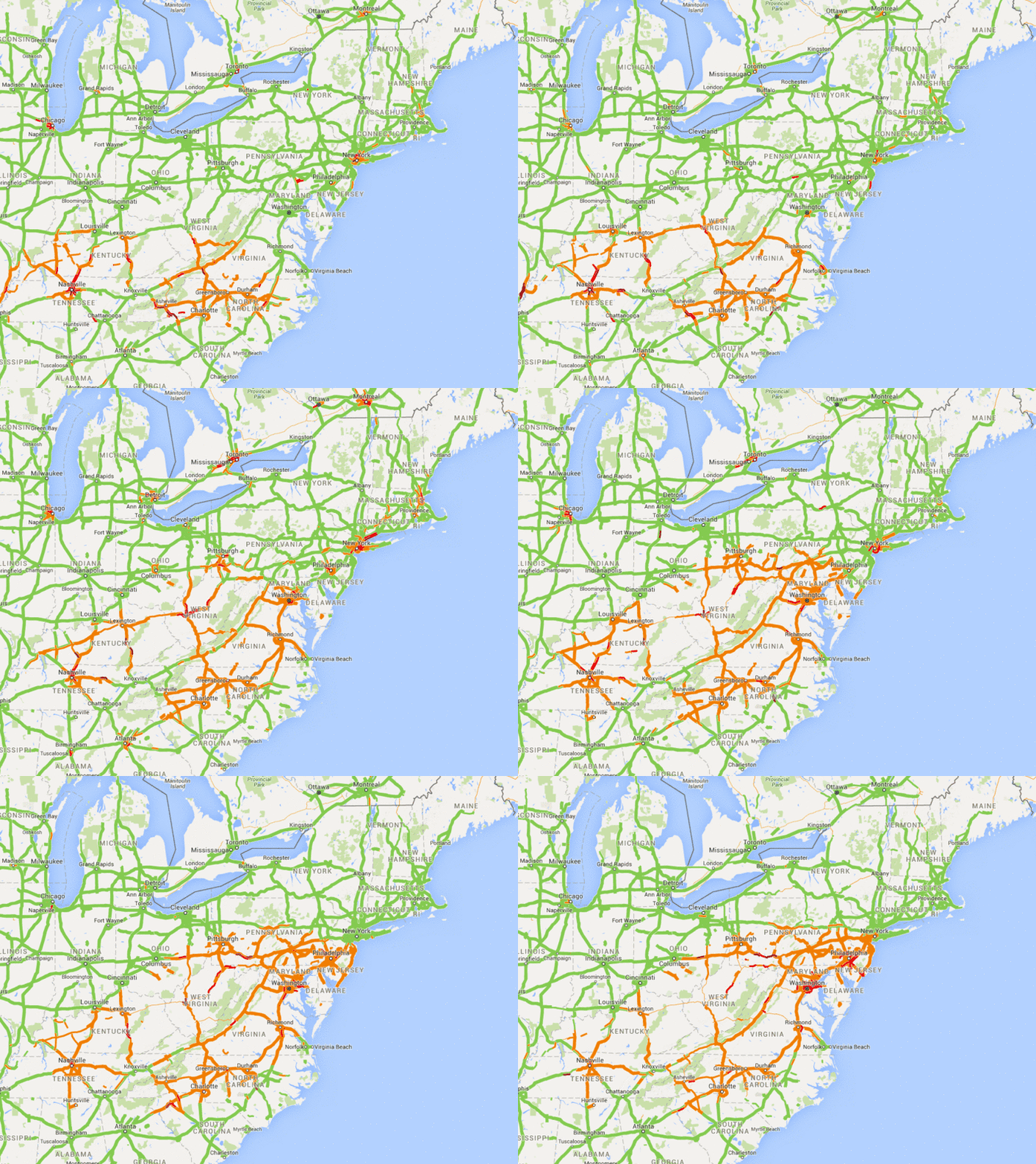
Screen-capping Google Maps during the January 2016 blizzard to see how bad traffic tracks with the storm
The morning of the January 2016 blizzard, my husband showed me Google Maps on his phone, with North Carolina's highways lit up with bad traffic: "I guess we know where the storm is!"
Inspired, I wrote a quick, crude PhantomJS script to take regular screenshots of Google Maps for the rest of the day. Then I selected the screenshots I wanted to use and turned them into a GIF using ImageMagick.
The final gif includes screengrabs taken roughly every half-hour. There's a gap between 2 and 4 p.m. (sadly, right about when the storm hits Washington, D.C., in earnest) when my script threw an error and I didn't notice.
This was a crude, pulled-together-in-10-min-or-so project, so nothing is done in a clean or optimized way. I'm saving it here on GitHub mostly for my own future reference.
I wrote a crude PhantomJS script (here it is) to snap screengrabs of Google Maps (for traffic) and WNYC's weather radar (which I didn't end up using) every 5 minutes or so. I added an extra 5-second delay to help make sure that all/most of the page had rendered before PhantomJS captured the image. Even then, about a fourth of my Google Maps screencaps came out mostly blank, with just the map search bar and other wrapper items and no actual map.
Most PhantomJS scripts include a phantom.exit(); command somewhere. I excluded it because I wanted it to keep running until I cancelled it (ctrl-C) in terminal.
To set things up (sorry — the initial download will take a while because I saved the images in the repo):
git clone git@github.com:alykat/snowzilla-traffic.git
cd snowzilla-traffic
mkvirtualenv snowzilla-traffic
brew install phantomjs
To run the script:
phantomjs mapcapture.js
If that fails, try:
phantomjs --ignore-ssl-errors=true mapcapture.js
To exit the script, hit ctrl-C.
I used ImageMagick to turn my frames into a GIF:
convert -background white -alpha remove -layers optimize-plus -delay 15x60 -resize 800 *.png -loop 0 filmstrip.gif
Then I brought the GIF into Photoshop to crop out the Google Maps controls. I probably also could have done this with ImageMagick, but Photoshop was the speediest/simplest way to do it at the time.
