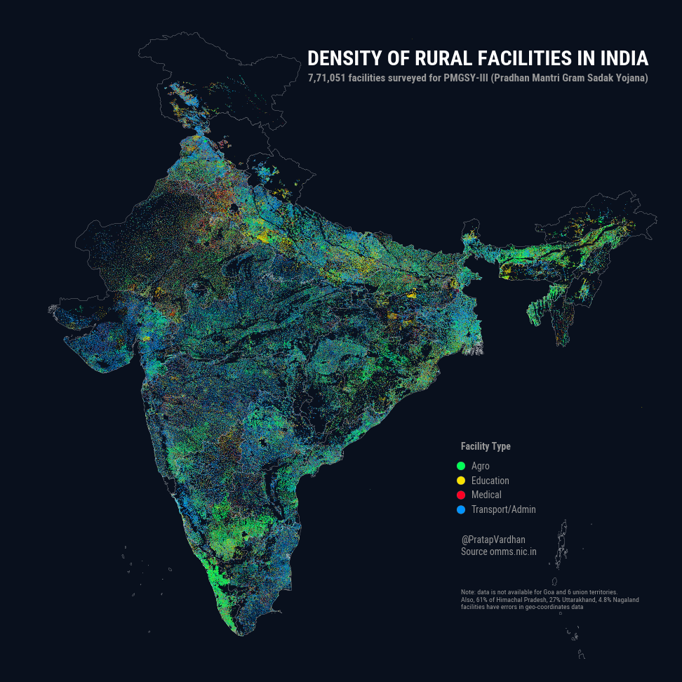
PMGSY (Pradhan Mantri Gram Sadak Yojana) released ~7,70,000 geo-tagged rural facilities data on it's portal omms.nic.in
- License: Government Open Data License - India (GODL).
- Citation: PMGSY Rural Facilities Dataset, Ministry of Rural Development 2020 http://omms.nic.in
- This repo contains cleaned csv files for individual state.
- Combined India dataset (120MB) is available on Kaggle
- Last updated on 27th November 2020. When possible please refer to original source (as data could update)
PMGSY recently released ~7,70,000 geo-tagged rural facilities data on it's portal. This map shows the density across India colored by category type (Agro, Education, Medical, Transport/Admin).
— Pratap Vardhan (@PratapVardhan) November 27, 2020
'Glow' signifies concentration. Read the thread for details. Caveats below. 1/n pic.twitter.com/occs2fRvcf
Columns include
- State
- District
- Block
- Habitation Name
- Habitation ID
- Facility Name
- Address
- File Upload Date
- Facility Category
- Facility Subcategory
- Lattitude
- Longitude
