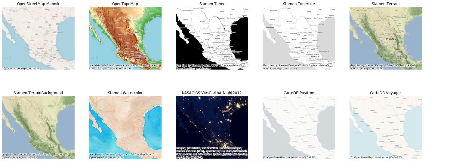
TileMap can crawl tiles based on bbox and add those tiles as basemap to matplotlib figures or write tile maps to disk into geospatial raster files. Bounding boxes can be passed in both GCJ02/WGS84 (EPSG:4326) and Spheric Mercator (EPSG:3857).
sh install.shfrom tilemap import TileMap, providers
# 定义瓦片提供服务商信息,以及瓦片存储位置
tile = TileMap(provider=providers.Amap.Normal, cache_folder='./tiles)
# 需要获取瓦片额范围
west, south, east, north = (
113.93329,22.57102,
113.94413,22.58131
)
# zoom 下载瓦片的级别,ll 表示 [west, south, east, north] 输入为经纬度
tile.bounds2img(west, south, east, north, zoom=18, ll=True)- 单通道
from tilemap import vis_geodata, providers

_, ax = vis_geodata(gdf, df, figsize=(6,6), alpha=.4, color='red', attribution=False, reset_extent=False)
ax.axis('off')- 双通道:高德卫星影像 + 高德地图标识
fig, ax = vis_geodata(df, figsize=(6,6), alpha=.4, color='red', attribution=False, reset_extent=False)
add_basemap(ax, provider=providers.Amap.Normal, attribution=False)
ax.axis('off')定义文件 ./tilemap/_providers.py, 目前配置了三个瓦片源: OpenStreetMap, 高德卫星瓦片,高德基础地图
providers = Bunch(
    OpenStreetMap = Bunch(
        Mapnik = TileProvider(
            url = 'https://{s}.tile.openstreetmap.org/{z}/{x}/{y}.png',
            sys='wgs',
            subdomains = 'abc',
            max_zoom = 18,
            attribution = '(C) OpenStreetMap contributors',
            name = 'OpenStreetMap.Mapnik'
        )
    ),
    Amap = Bunch(
        Satellite = TileProvider(
            # &size=1&scale=1
            url = 'http://webst0{s}.is.autonavi.com/appmaptile?style=6&x={x}&y={y}&z={z}',
            sys='gcj',
            max_zoom = 18,
            subdomains = '1234',
            attribution = '(C) AutoNavi',
            describe='style=6为影像图, style=7为矢量路网, style=8为影像路网',
            name = 'Amap.Satellite'
        ),
        Normal = TileProvider(
            url = 'http://webst0{s}.is.autonavi.com/appmaptile?style=8&x={x}&y={y}&z={z}',
            sys='gcj',
            max_zoom = 18,
            subdomains = '1234',
            attribution = '(C) AutoNavi',
            describe='style=6为影像图, style=7为矢量路网, style=8为影像路网',
            name = 'Amap.Normal'
        )

    )
)