Repository for the BostonTwin dataset API.
The basic requirements for the BostonTwin API are based on those of Sionna, plus some georeferencing libraries:
python>=3.8geopandasopen3dcontextily
and the corresponding dependencies.
We provide a requirement file for pip (requirements.txt) and conda (environment.yaml) to create a Python virtual environment with all the dependencies.
Additionally, we provide a DOCKERFILE to generate a container with all the required libraries. This is the preferred method.
- Clone this repo
- Download the BostonTwin dataset from https://repository.library.northeastern.edu/files/neu:h989t1201 into the
bostontwinfolder. - Install the requirements. We suggest using the provided DOCKERFILE:
a. From the boston_twin directory, run
docker build -t bostontwin -f DOCKERFILE .b. Run the container binding the boston_twin directory to the container:docker run --privileged=true --gpus=all --mount type=bind,src=".",target="/home/root/boston_twin" --env NVIDIA_DRIVER_CAPABILITIES=graphics,compute,utility --rm -it bostontwin - Run the bostontwin_demo Jupyter Notebook to see how to use BostonTwin, the Digital Twin of Boston!
- Refer to the documentation for additional information.
BostonTwin contains the 3D models of the structures [1] and of the antennas [2] in Boston, MA, and relies on Sionna to provide a realistic characterization of the propagation of the electromagnetic signal in the area.
The API offers geo-referencing tools to interact with and manipulate the digital twin. Please refer to the bostontwin_demo Jupyter Notebook to see how to use BostonTwin.
 The 3D models of BostonTwin are derived from [1] and can be downloaded from http://hdl.handle.net/2047/D20623157. The 3D information for each model is encoded in a PLY file in the
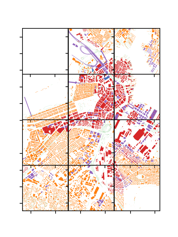
 meshes folder. The 2D footprint and other information are also available in the GeoJSON of the corresponding tile. For instance, each model has a level of detail (LOD) of the 3D model, encoded according to the CitySchema documentation. In the above figure, we report a visualization of the LOD of the current models for the central area of Boston.
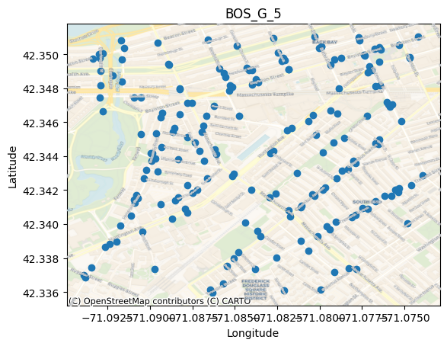
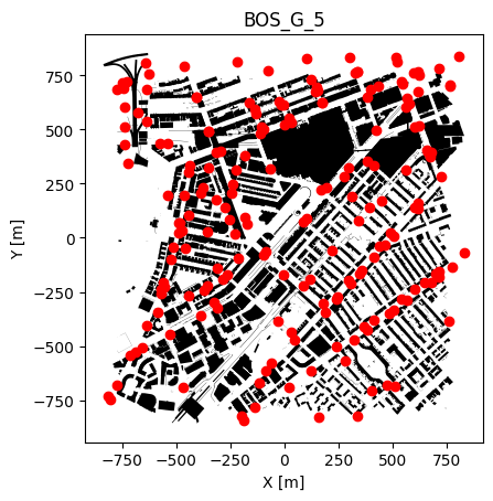
Besides the 3D models of the buildings in Boston, BostonTwin contains the geo-referenced location of the real wireless antenna throughout the city, according to [2]. That can be used to study, analyze and design optimization problems and solutions in a real world setting, having realistic data to start from.
If you use BostonTwin in a scientific work, please cite it as:
Paolo Testolina, Michele Polese, Pedram Johari, and Tommaso Melodia. 2024. Boston Twin: the Boston Digital Twin for Ray-Tracing in 6G Networks. In Proceedings of the 15th ACM Multimedia Systems Conference (MMSys '24). Association for Computing Machinery, New York, NY, USA, 441–447. https://doi.org/10.1145/3625468.3652190
BibTeX:
@inproceedings{10.1145/3625468.3652190,
author = {Testolina, Paolo and Polese, Michele and Johari, Pedram and Melodia, Tommaso},
title = {Boston Twin: the Boston Digital Twin for Ray-Tracing in 6G Networks},
year = {2024},
isbn = {9798400704123},
publisher = {Association for Computing Machinery},
address = {New York, NY, USA},
url = {https://doi.org/10.1145/3625468.3652190},
doi = {10.1145/3625468.3652190},
pages = {441–447},
numpages = {7},
keywords = {Digital Twin, Ray Tracing, Wireless Networks},
location = {<conf-loc>, <city>Bari</city>, <country>Italy</country>, </conf-loc>},
series = {MMSys '24}
}[1] The 3D models of the structures in Boston are published by the Boston Planning and Development Agency (BPDA) [https://www.bostonplans.org/3d-data-maps/3d-smart-model].
[2] The antenna location was obtained from the City of Boston's Open Data hub [https://data.boston.gov/].
This work was partially supported by the National Telecommunications and Information Administration (NTIA)’s Public Wireless Supply Chain Innovation Fund (PWSCIF) under Award No. 25-60-IF011.


