The ClearSCD model: Comprehensively leveraging semantics and change relationships for semantic change detection in high spatial resolution remote sensing imagery
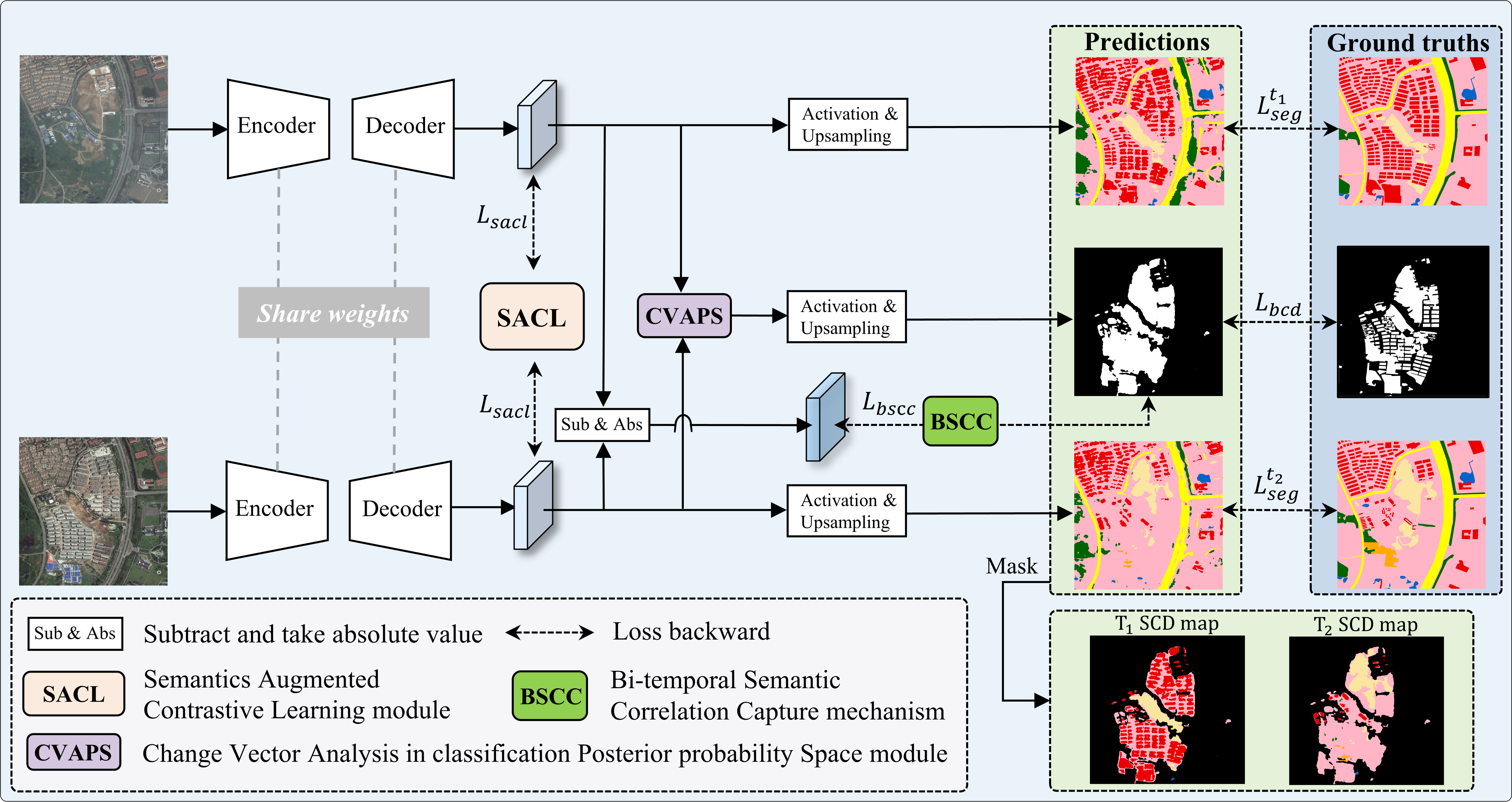
A remote sensing semantic change detection model, Comprehensively leveraged sEmantics and chAnge Relationships Semantics Change Detection model, named ClearSCD.
This new method draws inspiration from the mutual reinforcement of semantic and change information in the multi-task learning model.
The main innovations in ClearSCD are as follows:
-
We introduced a supervised Semantics Augmented Contrastive Learning (SACL) module, utilizing both local and global data features, along with cross-temporal differences.
-
A Bi-temporal Semantic Correlation Capture (BSCC) mechanism is designed, allowing for the refinement of semantics through the output of the Binary Change Detection (BCD) branch.
-
A deep CVAPS module in classification posterior probability space is developed to execute BCD by integrating semantics posterior probabilities instead of high-dimensional features.
-
Download Hi-UCD series dataset.
-
Deal with the dataset using
clip_image.py,deal_hiucd.py, andwrite_path.pyfrom the folder scripts.
Note: After running thedeal_hiucd.py, the classification codes in Hi-UCD with the land cover class in order minus 1, the unlabeled region as 9 in bi-temporal semantic maps, and unlabeled as 255 in BCD. -
Run
main.py, then you will find the checkpoints in the results folder.
If you use the ClearSCD codes or the LsSCD dataset, please cite our paper:
@article{TANG2024299,
title = {The ClearSCD model: Comprehensively leveraging semantics and change relationships for semantic change detection in high spatial resolution remote sensing imagery},
author = {Kai Tang and Fei Xu and Xuehong Chen and Qi Dong and Yuheng Yuan and Jin Chen},
journal = {ISPRS Journal of Photogrammetry and Remote Sensing},
volume = {211},
pages = {299-317},
year = {2024},
issn = {0924-2716},
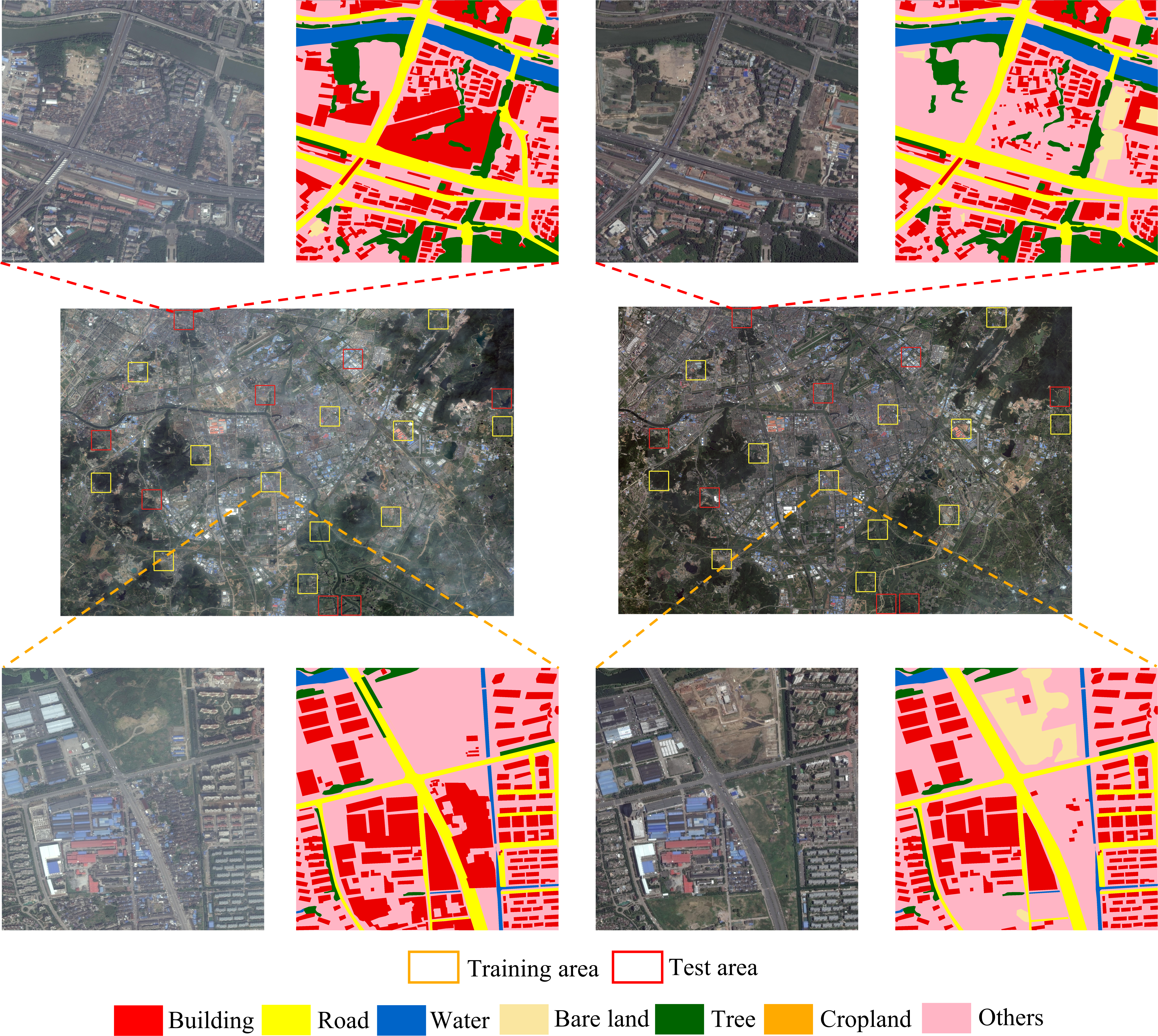
}We will publish a large-scale semantic change detection (LsSCD) dataset, which consists of Google Earth images from September 2013 and August 2015, with a spatial resolution of 0.6 m and a full size of 48000 × 32500 pixels.
LsSCD reveals urban and rural land cover changes in the city of Nanjing, the capital of Jiangsu Province, China.
Seven LULC types, including building, road, water, bare land, tree, cropland, and others, were recorded in LsSCD.
LsSCD download link (comming soon)

