RMap (RadarMapping), a method to generate highprecision 3D maps using radar point clouds extracted from an mmWave sensor.
We present an end-to-end pipeline for generating the 3D maps from radar point clouds and demonstrate how these maps can be leveraged to construct a 3D map resembling lidar-based maps through UpPoinTr.

- For the coloRadar dataset, the maps generated using radar and lidar (also lidar_filtered - considering lidar measurements only in the range and FOV of radar). The maps are stored in data/ply. For the points along the trajectory, the data is stored in data/poses
- From the maps and poses, generate radar input and lidar groundtruth patches by:
python utils/poseSample.py --pcd_dir ./data/ply --input_dir <SAVE_INPUT_DIR> --gt_dir <SAVE_GT_DIR> - Train/Test the UpPoinTr network with the generated input (and gt) patches. More details are available in UpPoinTr repo.
- Combine the UpPoinTr predicted patches by
python combinescenePCD.py --pcd_dir ./data/ply --pred_dir <PREDICTED_PATCHES_DIR>
This saves the final combined map for scene and also outputs the CD-L1 and CD-L2 metrics
- Install octomap
- ROS package dependecies:
- Create a custom launch file similar to ocotomap_radar_analysis/launch/ocotmap_mapping.launch file
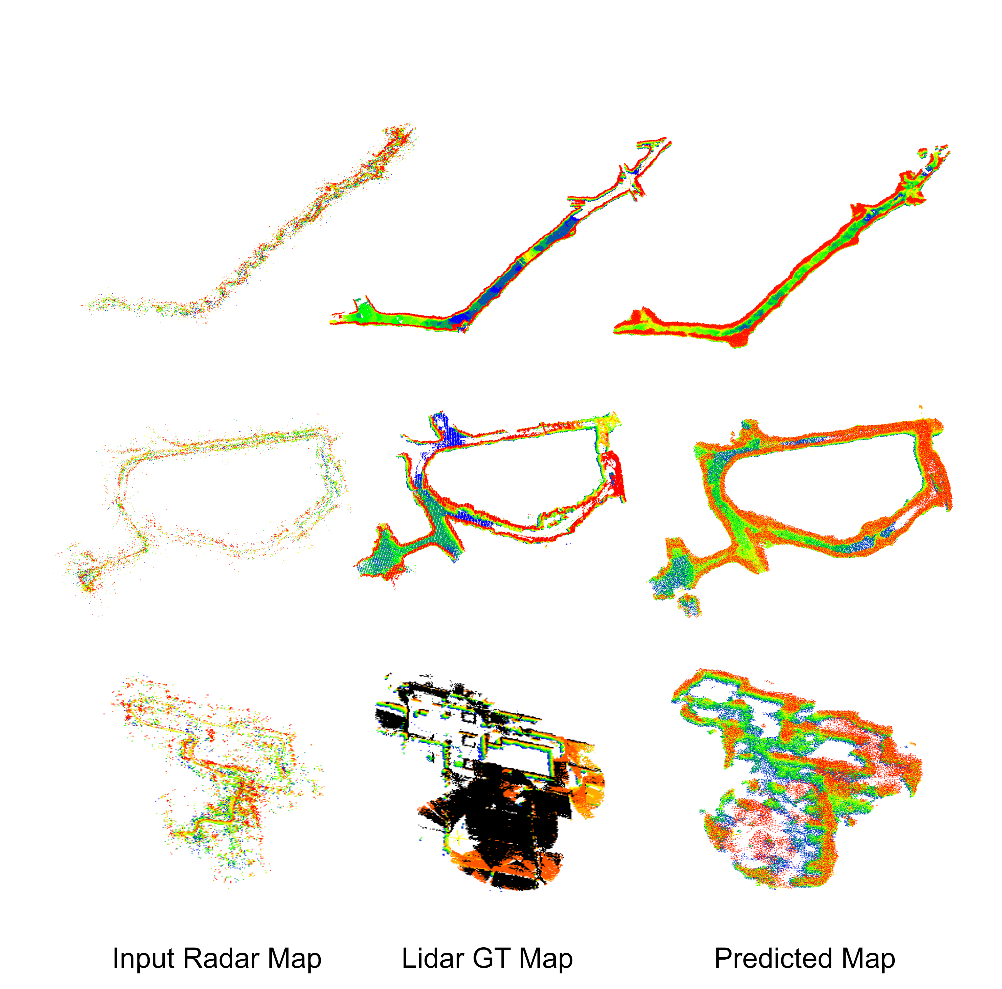
RMap genrated maps for ColoRadar dataset:

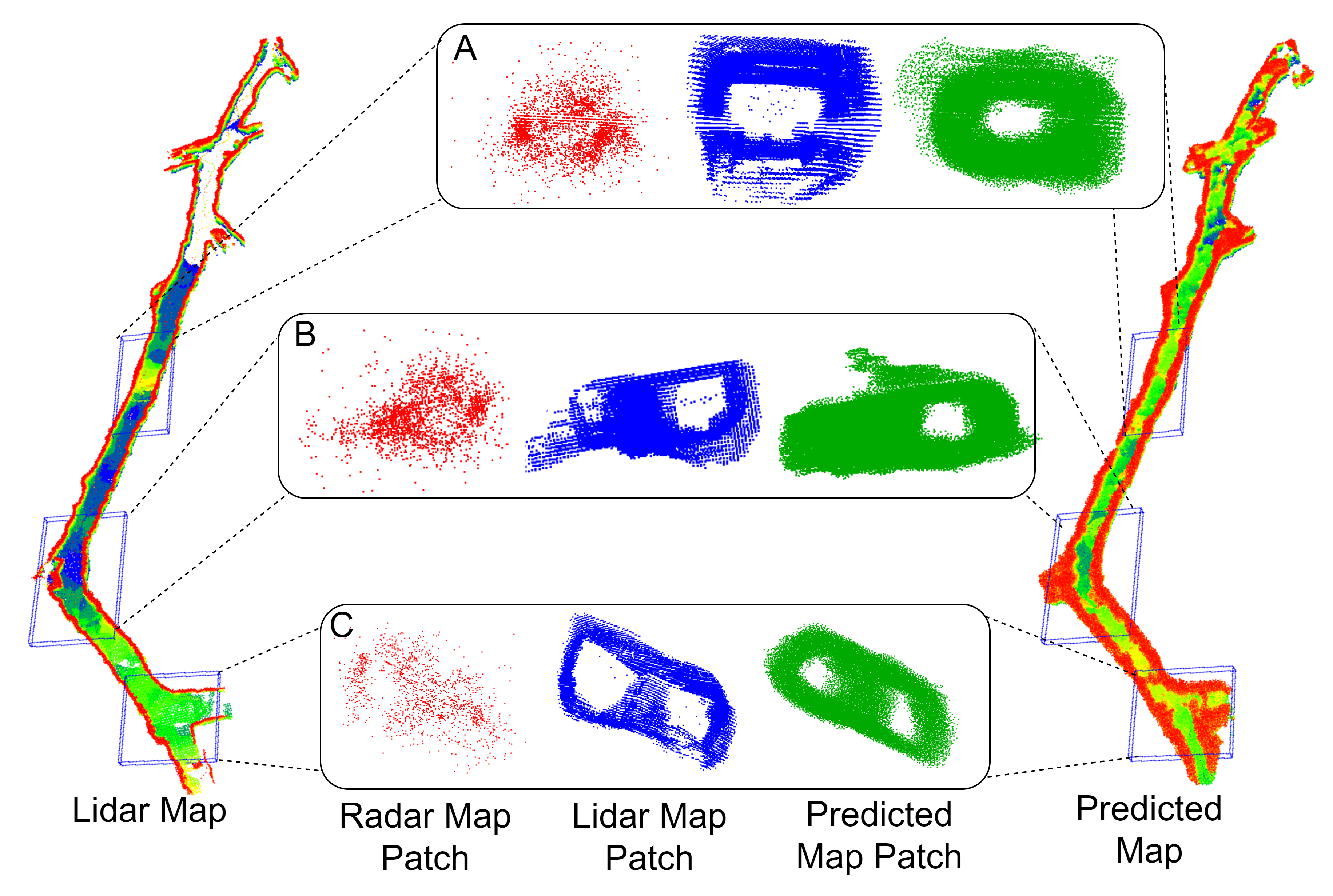
Through this crosssection analysis, we see that the original radar map consists primarily of noise. However, the RMap generated map has a similar structure to the lidar map, distinguishing between free space and occupied space.

If you find our work useful in your research, please consider citing:
@article{mopidevi2023rmap,
  title={RMap: Millimeter-Wave Radar Mapping Through Volumetric Upsampling},
  author={Mopidevi, Ajay Narasimha and Harlow, Kyle and Heckman, Christoffer},
  journal={arXiv preprint arXiv:2310.13188},
  year={2023}
}