please refer to VINS-Fusion Github
mkdir catkin/src
cd catkin/src
mkdir result
cd catkin/src
git clone https://github.com/baaixw/VINS-Fusion-for-UrbanNavDataset-Evaluation
cd ..
catkin_make
https://github.com/IPNL-POLYU/UrbanNavDataset
cd catkin
./all.sh
important note: remember to change your own path for result and data
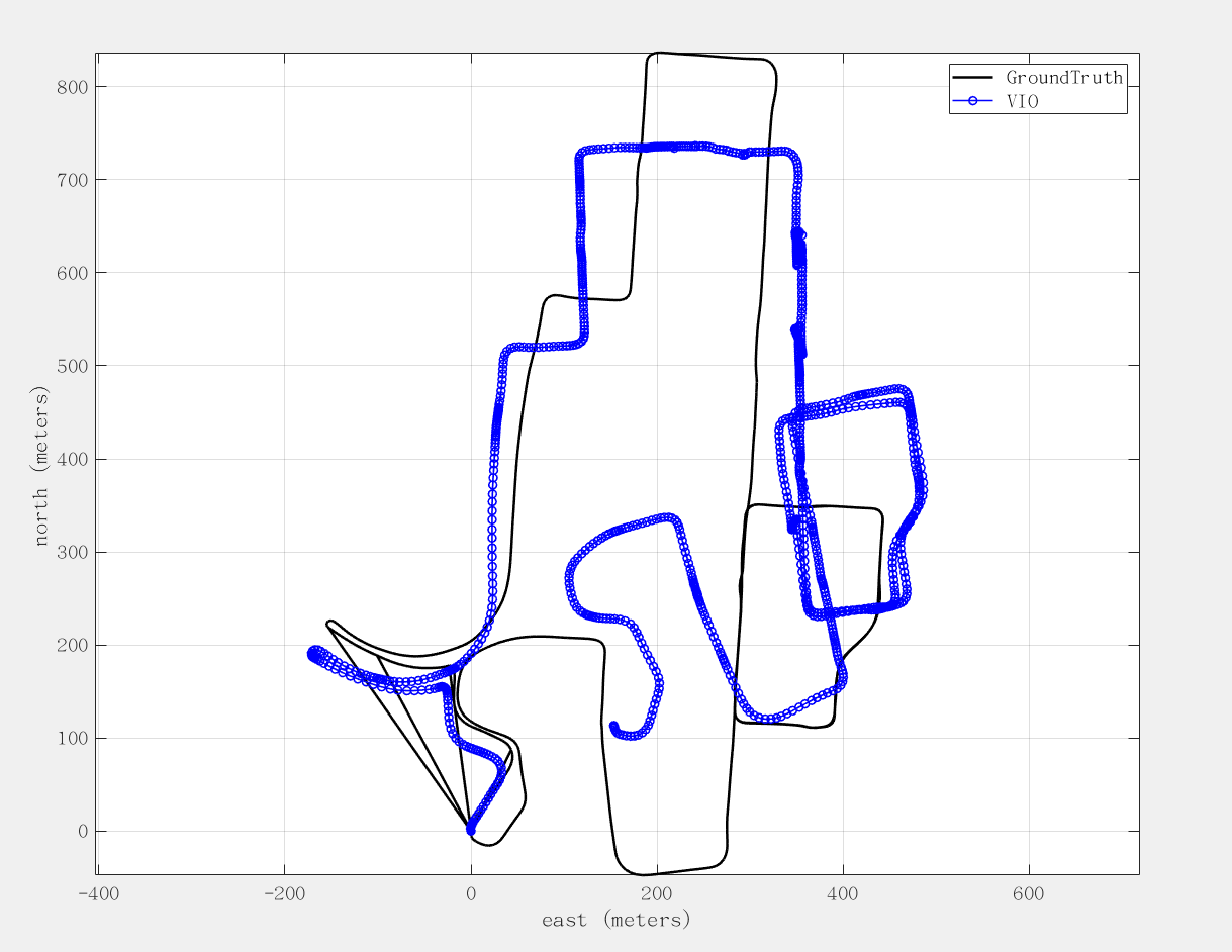
- When Left camera is used, set estimate_extrinsic: 0 (Have an accurate extrinsic parameters) and the evaluation result as follows:
  max	 15.405519
  mean 	 0.681131
  median 0.384471
  min	 0.000118
  rmse	 1.142427
  sse	 2004.693594
  std    0.917169
- Trajectory
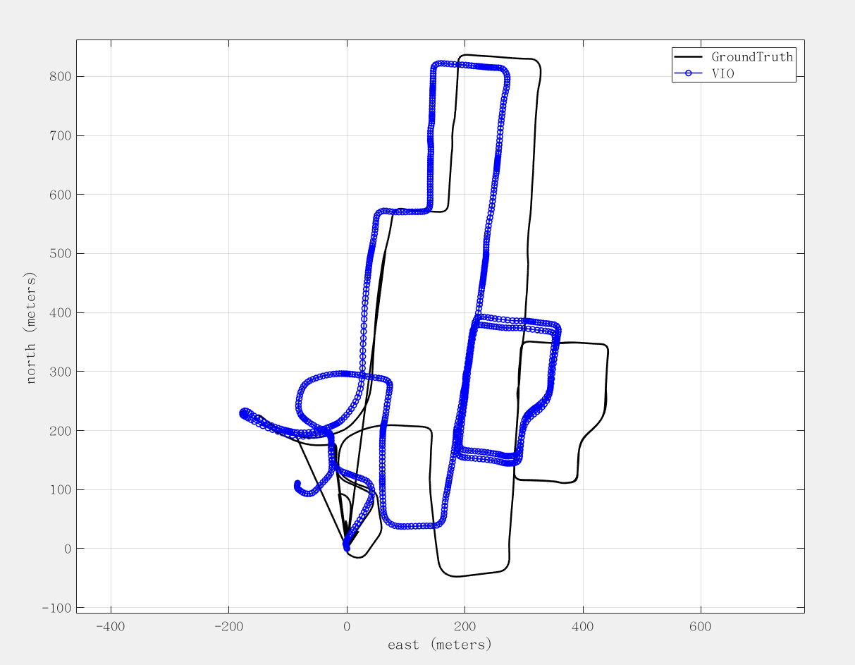
- When Stereo camera is used, set estimate_extrinsic: 1,and set td: 0.05
- Interestingly, we play the bag file starting from second 1 (rosbag play -s 1 Whampoasensors.bag), then the data can initialize successfully, otherwise fail. This is interesting point, there must be a reason behind that. The evaluation result as follows:
  max	 2.372637
  mean	 0.327725
  median 0.197800
  min	 0.000059
  rmse	 0.505415
  sse	 392.107044
  std	 0.384760
- Trajectory
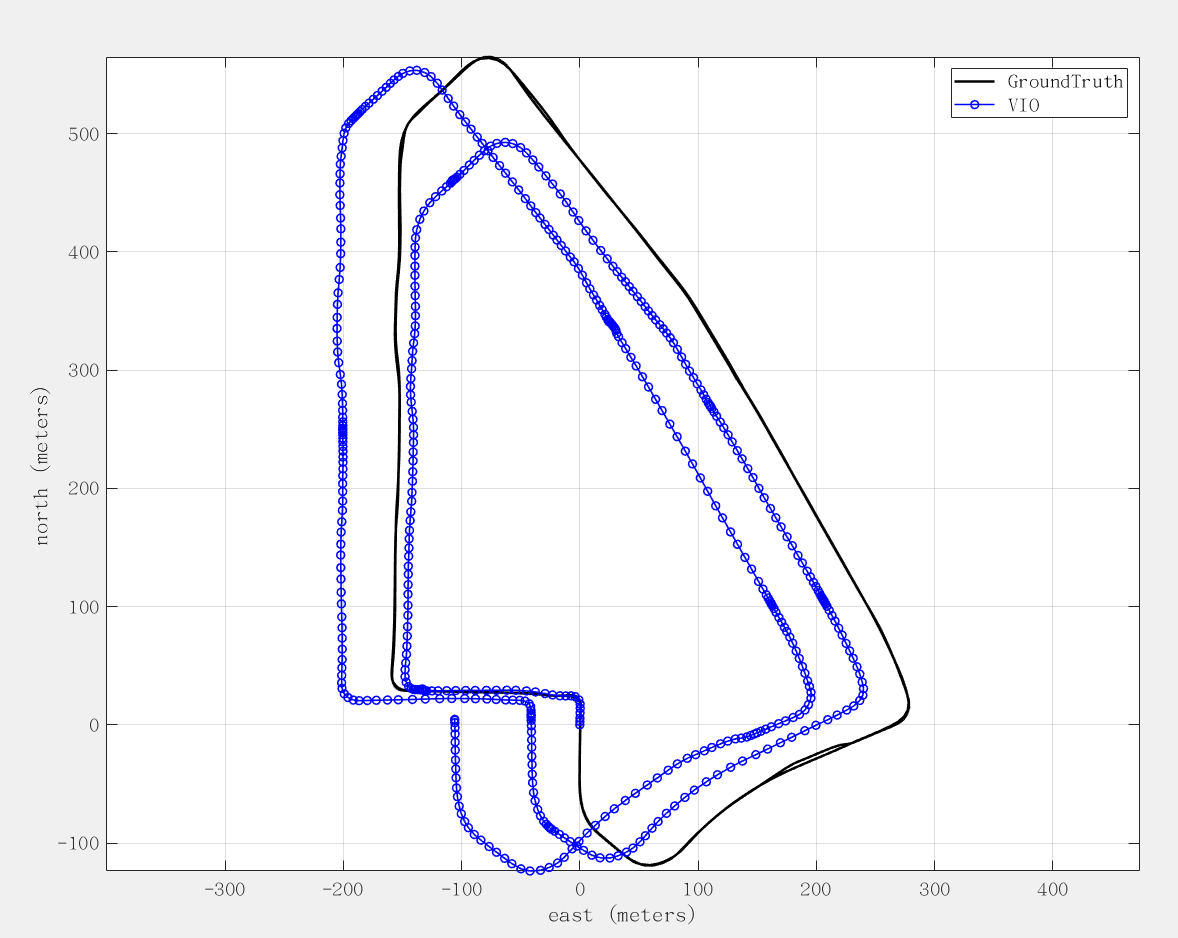
- When Left camera is used, set estimate_extrinsic: 0 (Have an acurate extrinsic parameters) The evaluation result as follows:
  max	 4.726060
  mean 	 0.734495
  median 0.401529
  min	 0.000484
  rmse	 1.145298
  sse	 1029.691026
  std	 0.878763
- Trajectory
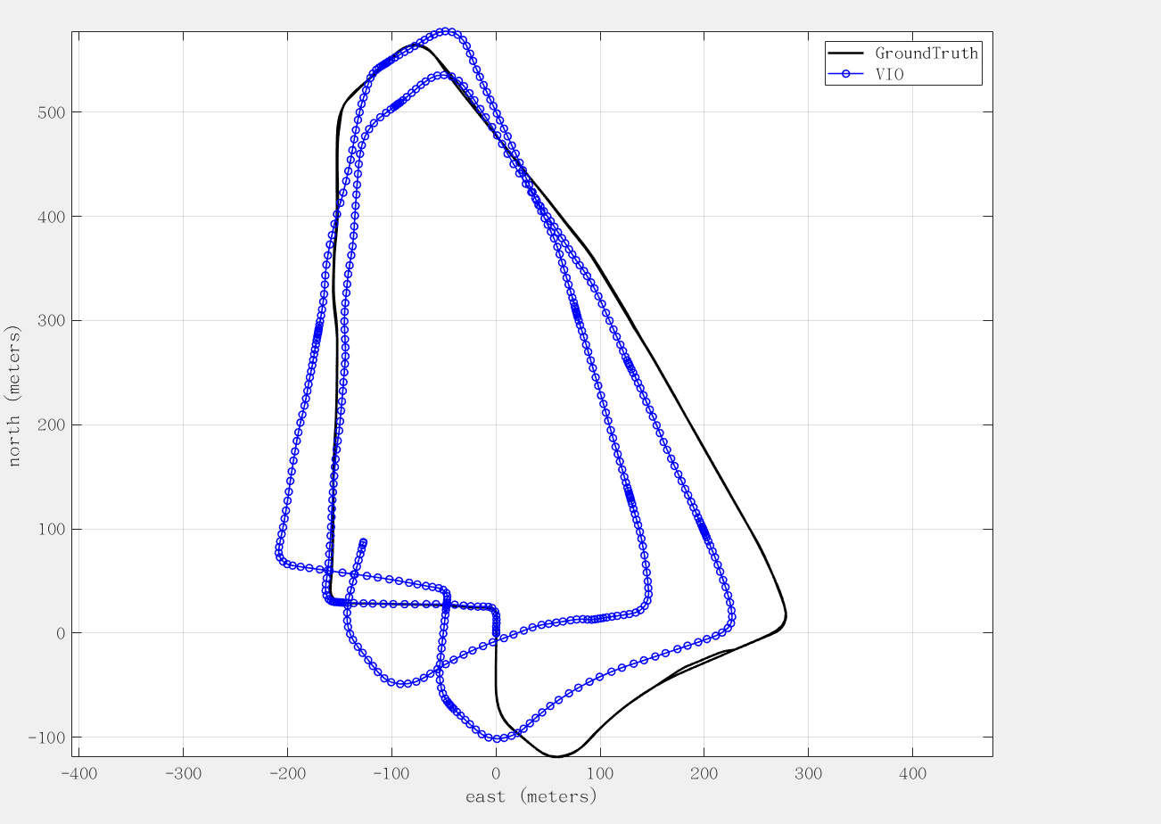
- Stereo camera is used, set estimate_extrinsic: 1,and set td: 0. The evaluation result as follows:
  max	 2.909680
  mean	 0.480456
  median 0.314631
  min	 0.000184
  rmse	 0.726379
  sse	 414.187215
  std	 0.544783
- Trajectory
Fail, T-T
- Python package for the evaluation of odometry and SLAM: github.com/MichaelGrupp/evo
- evo_rpe tum groundTruth.csv vio.csv --plot --plot_mode xyz --save_plot ./VINSplot --save_results ./VINS.zip
The VINS-Fusion (https://github.com/HKUST-Aerial-Robotics/VINS-Fusion) framework is used for performance evaluation of dataset collected in Hong Kong urban canyons. When performing coordinate transformation,some functions are derived from GraphGNSSLib (https://github.com/weisongwen/GraphGNSSLib). We appreciate and respect the authors' efforts for their contribution to the research community. If there is any thing inappropriate, please contact me through 19078299r@connect.polyu.hk (BAI).


