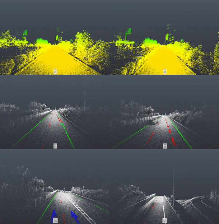
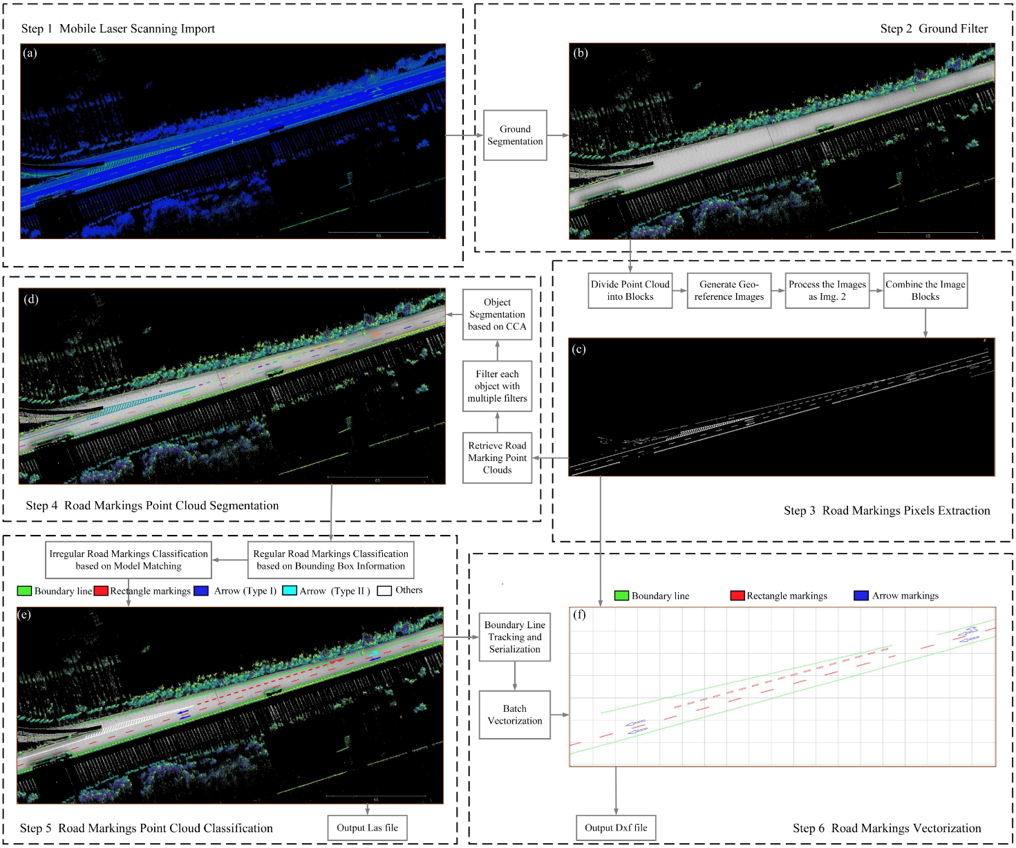
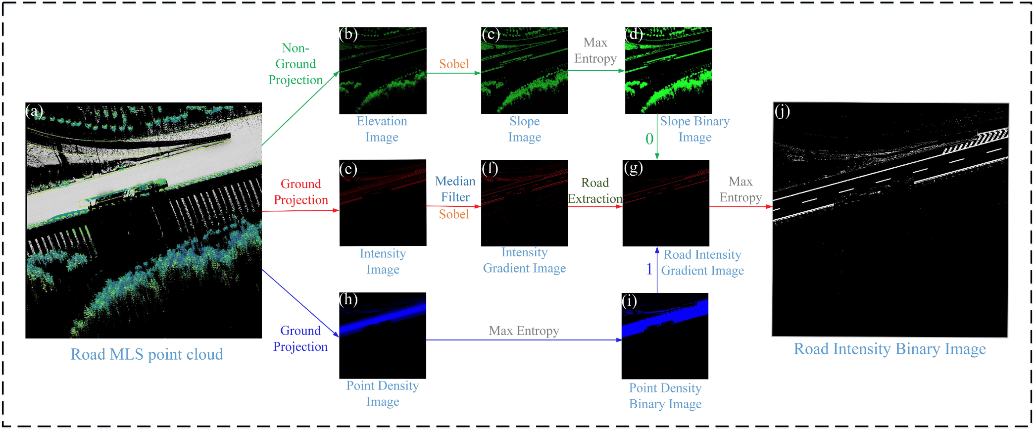
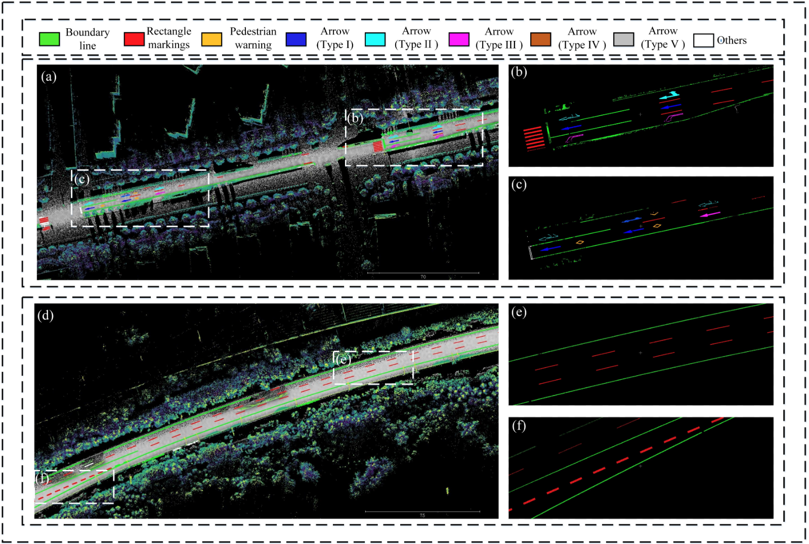
This repository contains a C++ implementation of the automatic extraction, classification and vectorization of road markings from MLS point cloud. It's based on traditional image & point cloud processing approaches, which can act as the easy baseline for novel learning-based methods.
Version 1.2: passed on Ubuntu 16.04. For former versions, please check the other branches.
Dependent 3rd Party Libs: Eigen3, PCL1.8, OpenCV2, LibLas, DXFLib
Application Scenarios: MLS or ALS point cloud for highway or urban roads
-
Install dependent libs by
sh ./script/download_dependent_lib.sh. -
Build the repository:
mkdir build
cd build
cmake ..
make
cd ..
-
Prepare the model pool (take
./model_pool/xxxas an example) and configure the parameter list (take./config/xxx.txtas an example). -
Configure the input (
*.lasor*.pcdpoint cloud) and output path in./script/run_xxx.sh. -
Run
sh ./script/run_xxx.sh. -
Check the results in your output folder. You may use CloudCompare to visualize the point cloud and use AutoCAD or ShareCAD to visualize the dxf files.
If you find this code useful for your work or use it in your project, please consider citing:
@article{pan2019automatic,
  title={Automatic Road Markings Extraction, Classification and Vectorization from Mobile Laser Scanning Data.},
  author={Pan, Yue and Yang, B and Li, S and Yang, H and Dong, Z and Yang, X},
  journal={International Archives of the Photogrammetry, Remote Sensing \& Spatial Information Sciences},
  year={2019}
}
Thanks hibetterheyj for the effort to migrate the codes on Linux.


