Open Street Maps tile downloader script for offline usge. A small example of offline tile usage.
I was looking for a fast and easy way to download and use OSM tiles to my projects. Google Maps provides a big and excellent documentation of how to use every part of the API and the maps. For Open Street Maps is a lit bit trickier and more difficult.
Inspired by this script.
Use osm.py script and download tiles in .png format.
$ python osm.py <start lat> <start lng> <finish lat> <finish lng> <min zoom> <max zoom> <type>
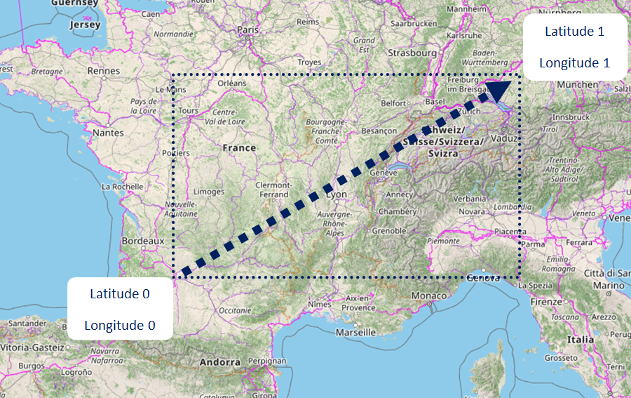
Start lat, lng must be lower than finish lat, lng as image below.
Open Street Maps
$ python osm.py 34.979067 23.350545 35.485885 26.310979 0 6 osm
Satelite Images
$ python osm.py 34.979067 23.350545 35.485885 26.310979 7 10 world
$ git clone https://github.com/georgealexakis/osm-offline.git
$ cd osm-offline
$ npm install
View index.html on web browser.
