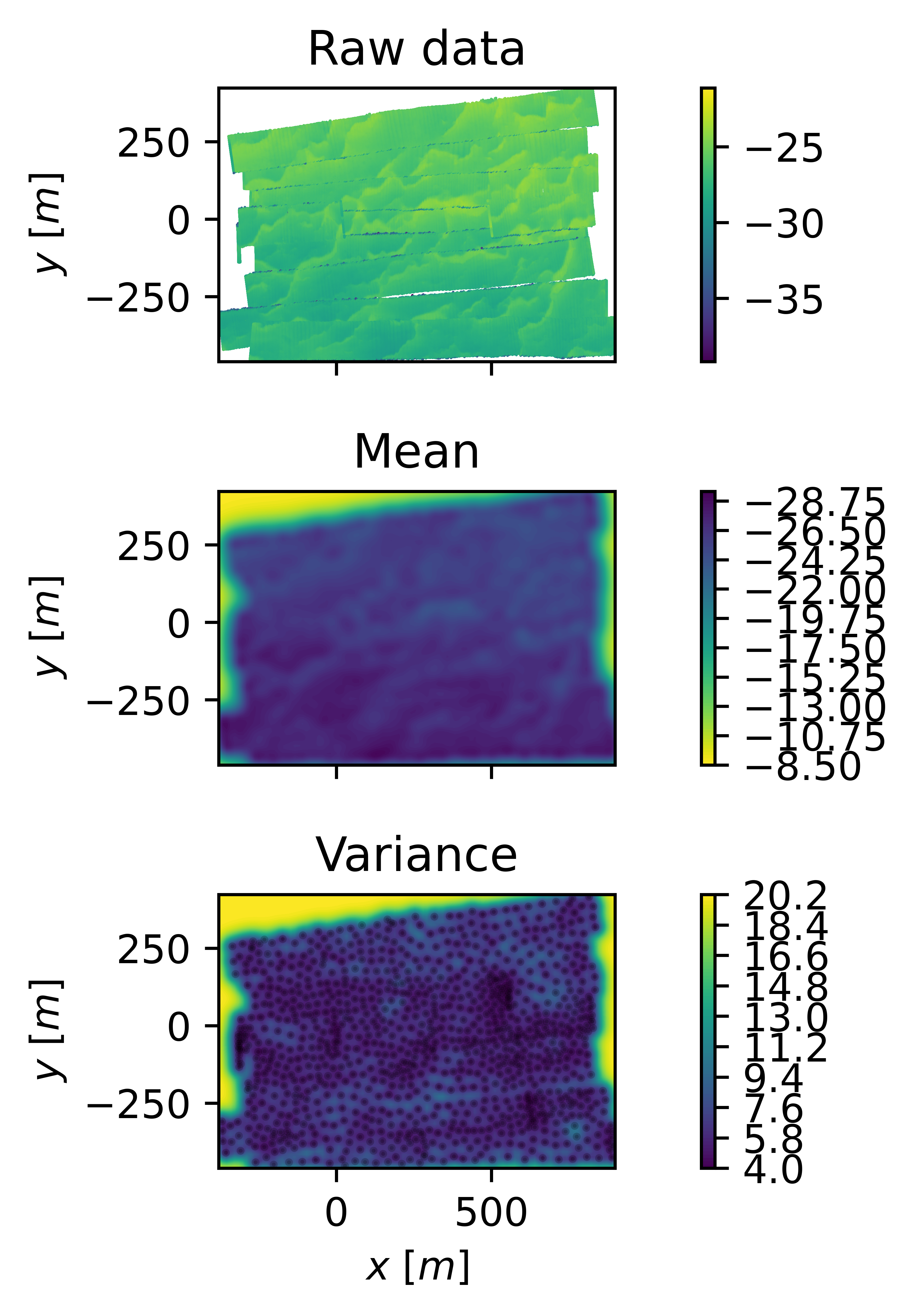
Collection of ROS packages for localization, map building and SLAM with autonomous underwater vehicles and sonar sensors.
- ROS Noetic
- AUVLIB here
Only required if working with the bathy_graph_slam package (currently under development and ignored during building):
Python deps:
sudo apt install python3-pygame python3-scipy python3-configargparse python3-numpy
pip install configargparse pygame
Make sure your scipy version is >= 1.4.0
If you're going to be working with Gaussian Processes maps, also install
- Pytorch here
pip install gpytorch open3d
If you want to try waypoint navigation for an AUV, clone this repo within your catkin workspace to plan missions in RVIZ
- Waypoint_navigation_plugin here
This is a collection of ROS packages. Just clone the repo within your catking workspace and run
rosdep install --from-paths catkin_ws --ignore-src --rosdistro=$ROS_DISTRO -y
catkin_make -DCMAKE_BUILD_TYPE=Release install
Finally, add the following lines to your ~/.bashrc file adapted to your own installation
export PATH=$PATH:/path/to/folder/auvlib/install/share
export PYTHONPATH=$PYTHONPATH:/path/to/folder/auvlib/install/lib
If you experience errors with GTSAM libraries not being found, add this line at the end of your .bashrc
export LD_LIBRARY_PATH=$LD_LIBRARY_PATH:/usr/local/lib
If you find the repo and datasets useful, please cite us.
@article{torroba2022fully,
  title={Fully-Probabilistic Terrain Modelling and Localization With Stochastic Variational Gaussian Process Maps},
  author={Torroba, Ignacio and Sprague, Christopher Iliffe and Folkesson, John},
  journal={IEEE Robotics and Automation Letters},
  year={2022},
  publisher={IEEE}
}

@article{torroba2023online,
  title={Online Stochastic Variational Gaussian Process Mapping for Large-Scale Bathymetric SLAM in Real Time},
  author={Torroba, Ignacio and Cella, Marco and Ter{\'a}n, Aldo and Rolleberg, Niklas and Folkesson, John},
  journal={IEEE Robotics and Automation Letters},
  year={2023},
  publisher={IEEE}
}

@inproceedings{tan2023data,
  title={Data-driven loop closure detection in bathymetric point clouds for underwater slam},
  author={Tan, Jiarui and Torroba, Ignacio and Xie, Yiping and Folkesson, John},
  booktitle={2023 IEEE International Conference on Robotics and Automation (ICRA)},
  pages={3131--3137},
  year={2023},
  organization={IEEE}
}
We provide a dataset collected with a hull-mounted MBES on a ship for toy demos. However the code will need to be tuned for applications in different setups (bathymetry, sensors, vehicle and so on).
We have now added a second with a survey collected with a HUGIN AUV under the ice in Antarctica. The dataset was introduced in this paper.
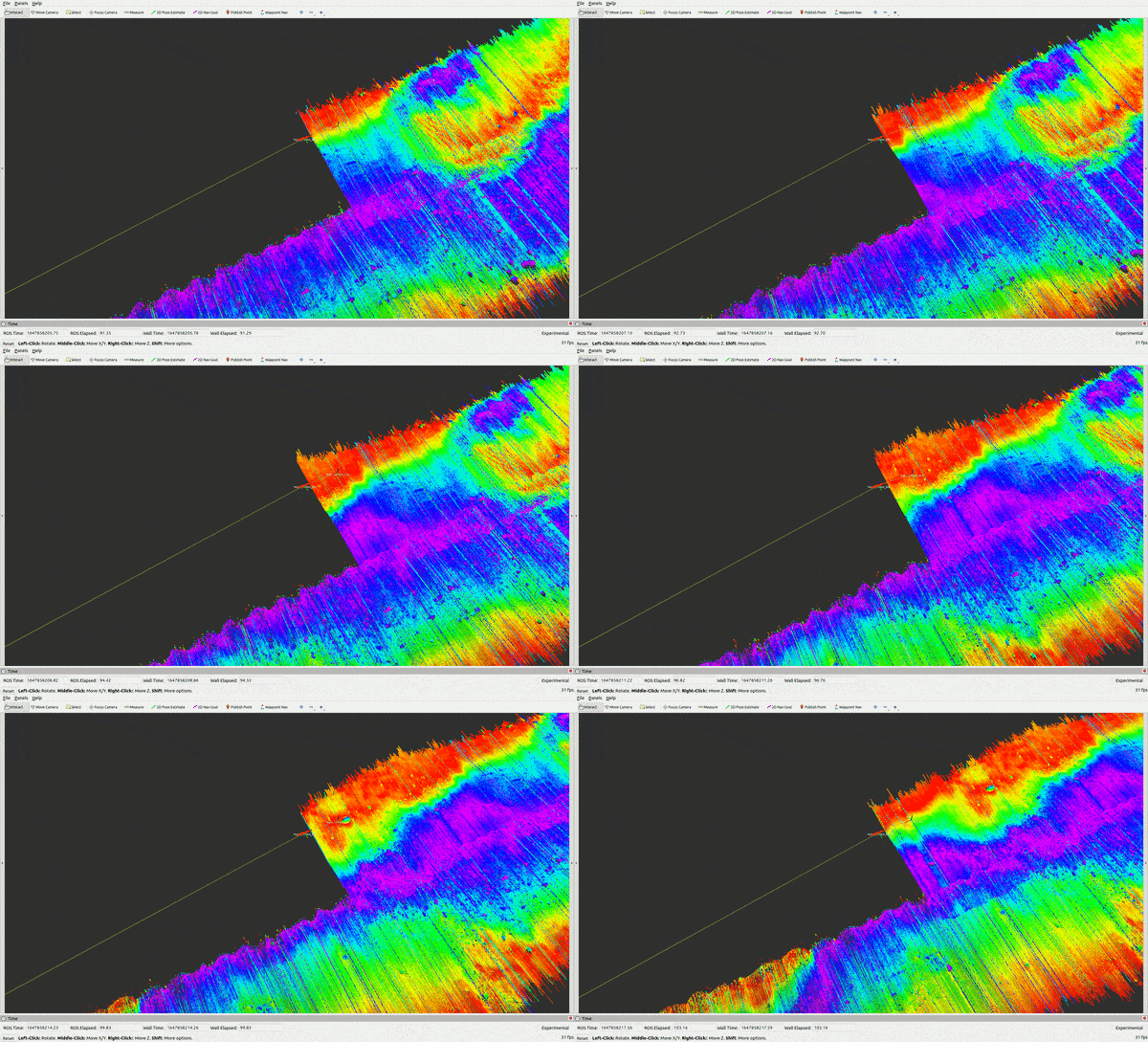
Reproduce a real bathymetric survey (gt):
roslaunch auv_model auv_environment.launch namespace:=hugin_0 mode:=gt start_mission_ping_num:=0
roslaunch auv_model auv_env_aux.launch
You should see in RVIZ the AUV and the MBES pings.
Simulate a bathymetric survey (sim):
roslaunch auv_model auv_environment.launch namespace:=hugin_0 mode:=sim
roslaunch auv_model auv_env_aux.launch
roslaunch basic_navigation basic_mission.launch manual_control:=True namespace:=hugin_0
The last command provides an interface to run the AUV manually with the keyboard (w=forward, s=backward a,d=+/-yaw, up,down=+/-pitch)
Alternatively, to plan and execute autonomous waypoint navigation missions in simulation, install this package.
roslaunch basic_navigation basic_mission.launch manual_control:=False namespace:=hugin_0
And add and publish waypoints through RVIZ as in their tutorial.
Example of multi-agent mission with 2 AUVs:
roslaunch auv_model auv_environment.launch namespace:=hugin_0
roslaunch auv_model auv_environment.launch namespace:=hugin_1 y:=10
roslaunch auv_model auv_env_aux.launch
roslaunch basic_navigation basic_mission.launch manual_control:=True namespace:=hugin_0
roslaunch basic_navigation basic_mission.launch manual_control:=True namespace:=hugin_1
*WP navigation isn't implemented yet for several AUVs and currently you'll need a manual controller per AUV, although this is easy to modify in the launch if required.
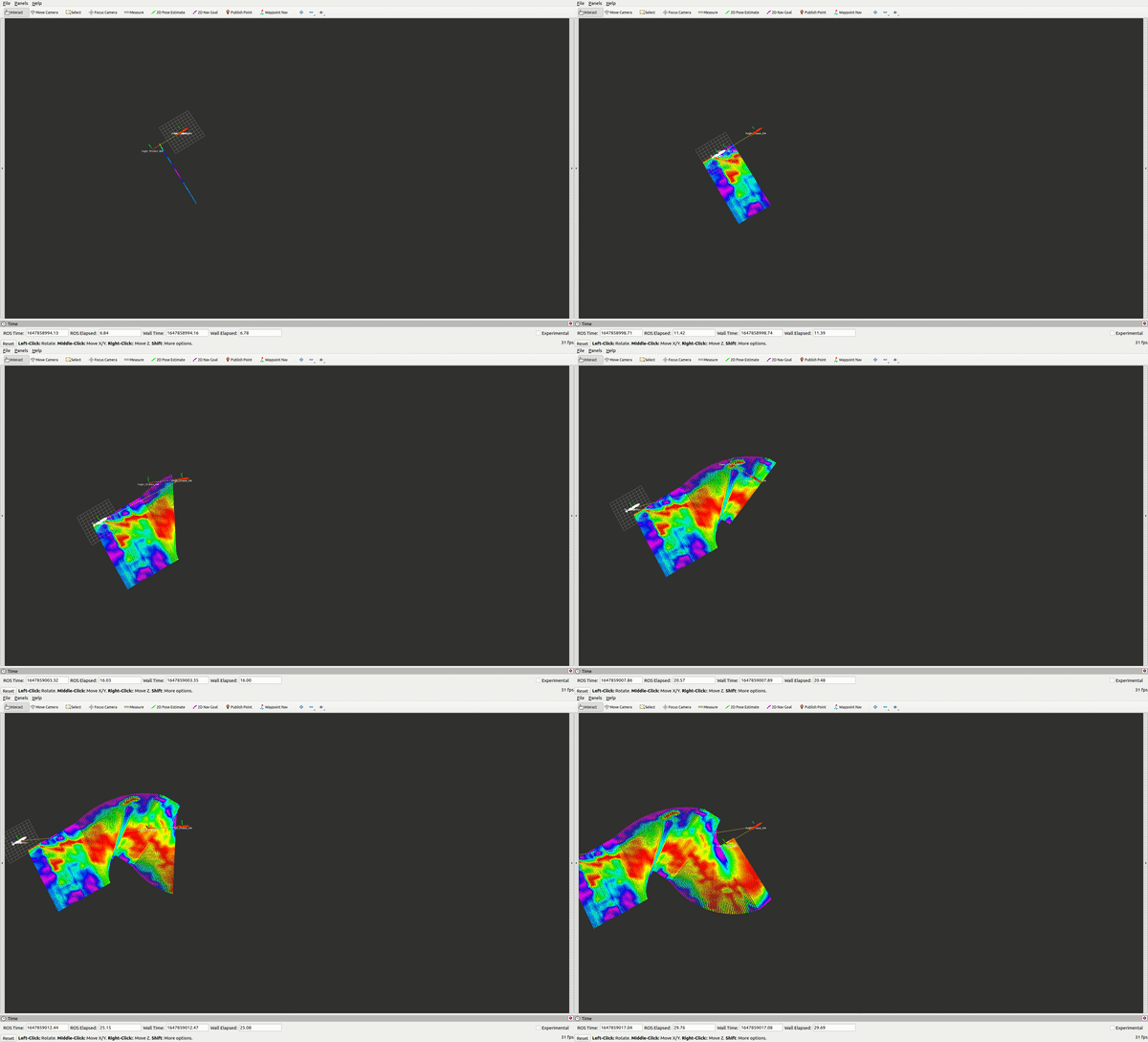
Replay the AUV bathymetric survey with a PF running on a mesh or a Gaussian process created from the bathymetry. Set "gp_meas_model==True" for the GP map, otherwise the PF measurement model will be based on raytracing over the mesh.
Note that you'll have to tune the filter parameters in 'auv_pf.launch' for your own application. The terrain provided in this demo is very challenging for localization.
roslaunch auv_particle_filter auv_pf.launch namespace:=hugin_0 mode:=gt start_mission_ping_num:=0
roslaunch auv_model auv_env_aux.launch
Check 'auv_pf.launch' for the main filter parameters
roslaunch auv_particle_filter auv_pf.launch namespace:=hugin_0 x:=-300 y:=-400
roslaunch auv_particle_filter auv_pf.launch namespace:=hugin_1 x:=-330 y:=-430
roslaunch auv_model auv_env_aux.launch
roslaunch basic_navigation basic_mission.launch manual_control:=True namespace:=hugin_0
roslaunch basic_navigation basic_mission.launch manual_control:=True namespace:=hugin_1
In order to create a dataset with propagated and fused AUV DR uncertainty + MBES noise into the sensor data, run:
roslaunch auv_model auv_env_aux.launch
roslaunch uncert_management ui_test.launch mode:=gt namespace:=hugin_0
Set the parameters start_mission_ping_num and end_mission_ping_num to adjust the lenght of the survey to be replayed. Once the end ping is reached, the system will save "ripples_svgp_input.npz" under the "~/.ros" folder. This file contains the MBES beams and their associated uncertainties, and can be used to train a SVGP map of the area.
Uncertainty propagation through sigma points can be a heavy process, so make sure you set the reply_rate such that all MBES beams can be processed on time, otherwise data will be lost.
To train a SVGP to regress the bathymetry collected and build a map with DIs or UIs, run the following command with the desired type:
/gp_map_training.py --survey_name ~/.ros/ripples_svgp_input.npz --gp_inputs di
Note this is not a ROS node. This script is based on the GPytorch implementation of SVGP, take a look at their tutorials to understand and tune the parameters. After the training, it will save the trained SVGP, a point cloud sampled from the SVGP posterior for visualization in RVIZ and some images. The output SVGP map (.pth) can be directly used for the PF-GP implementation above pointing the auv_pf.launch to it.
To run the RBPF SLAM framework:
roslaunch auv_model auv_environment.launch namespace:=hugin_0 mode:=gt
roslaunch auv_model auv_env_aux.launch mode:=gt
roslaunch rbpf_slam rbpf_slam.launch namespace:=hugin_0 particle_count:=20 num_particle_handlers:=4 results_path:=/path/to/save/results mode:=gt
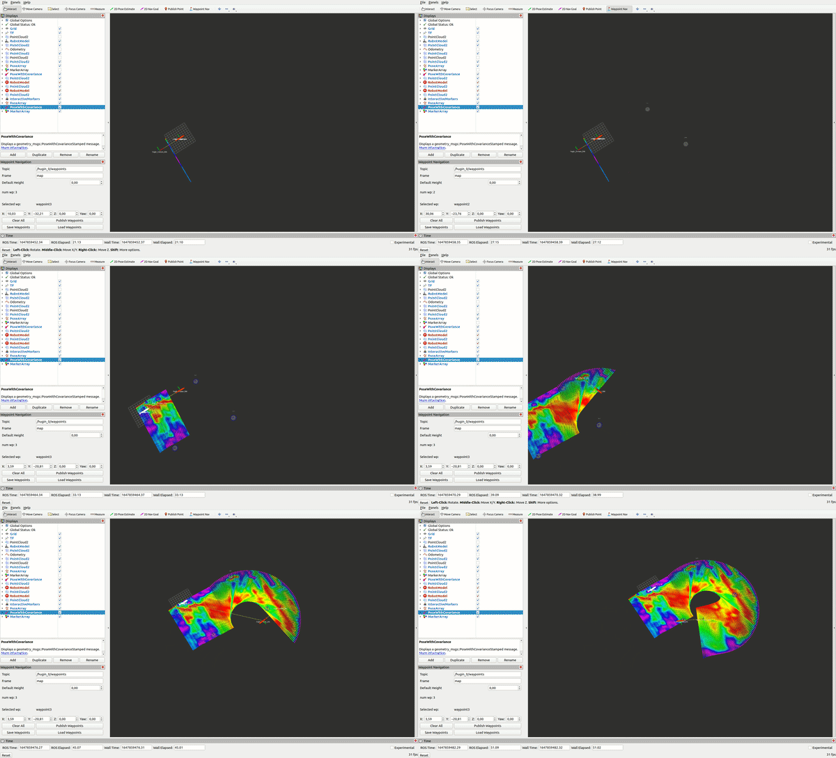
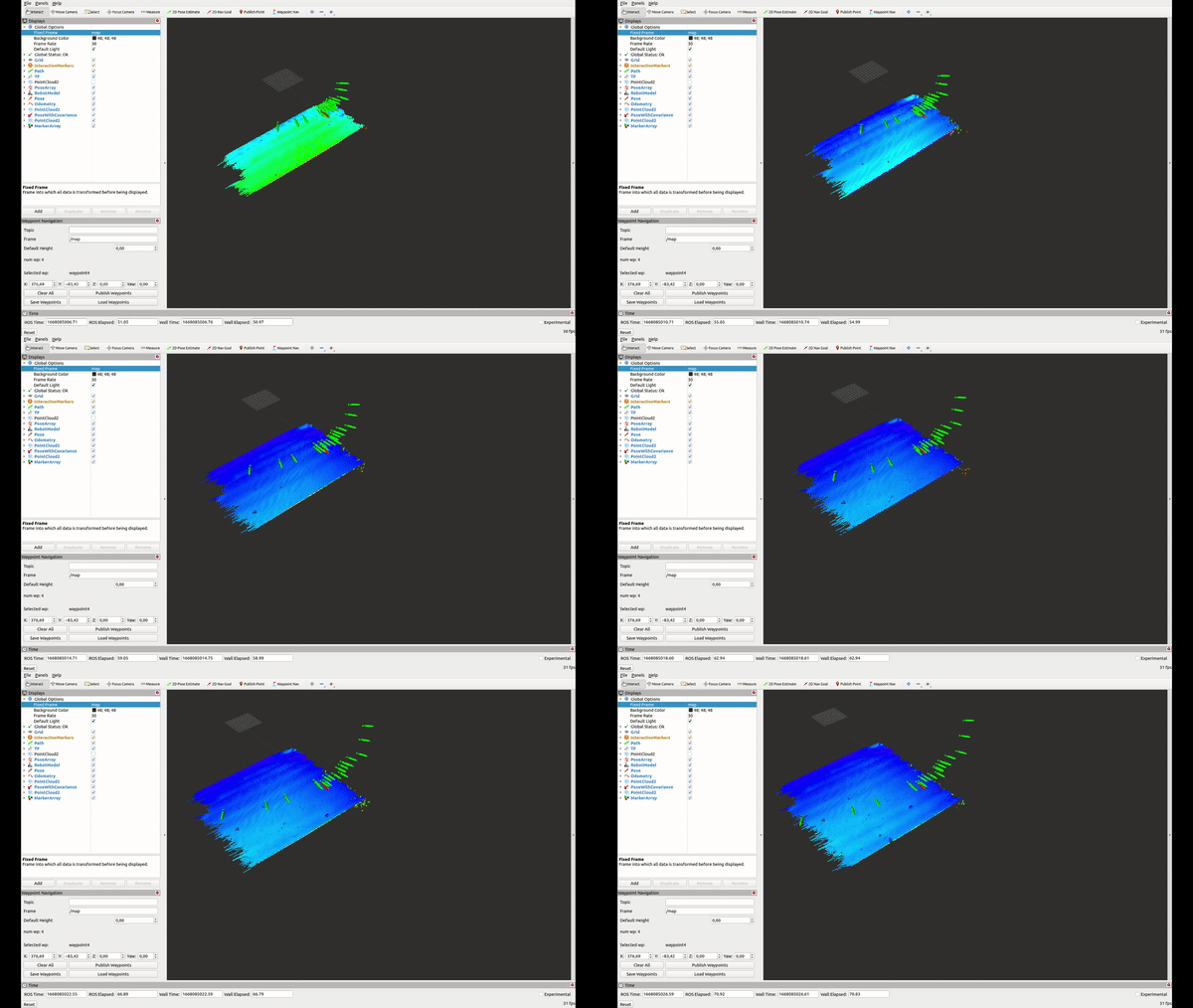
Once the RBPF terminal is ready, use the Waypoints in rviz to cage the area to map (use at least 4, the order doesn't matter) and publish them. If you're running a sim mission, the mission plan waypoints will suffice for this. You should see something like this.
The RBPF will stop and save the SVGP maps when the last ping has been replayed (see param end_mission_ping_num). You can also stop it calling
rostopic pub /gt/survey_finished std_msgs/Bool "data: false"
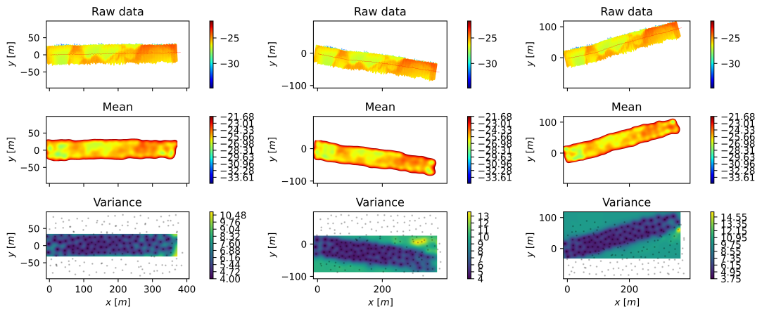
In order to plot a SVGP map offline, call
./plot_svgp.py /path/to/save/results 0
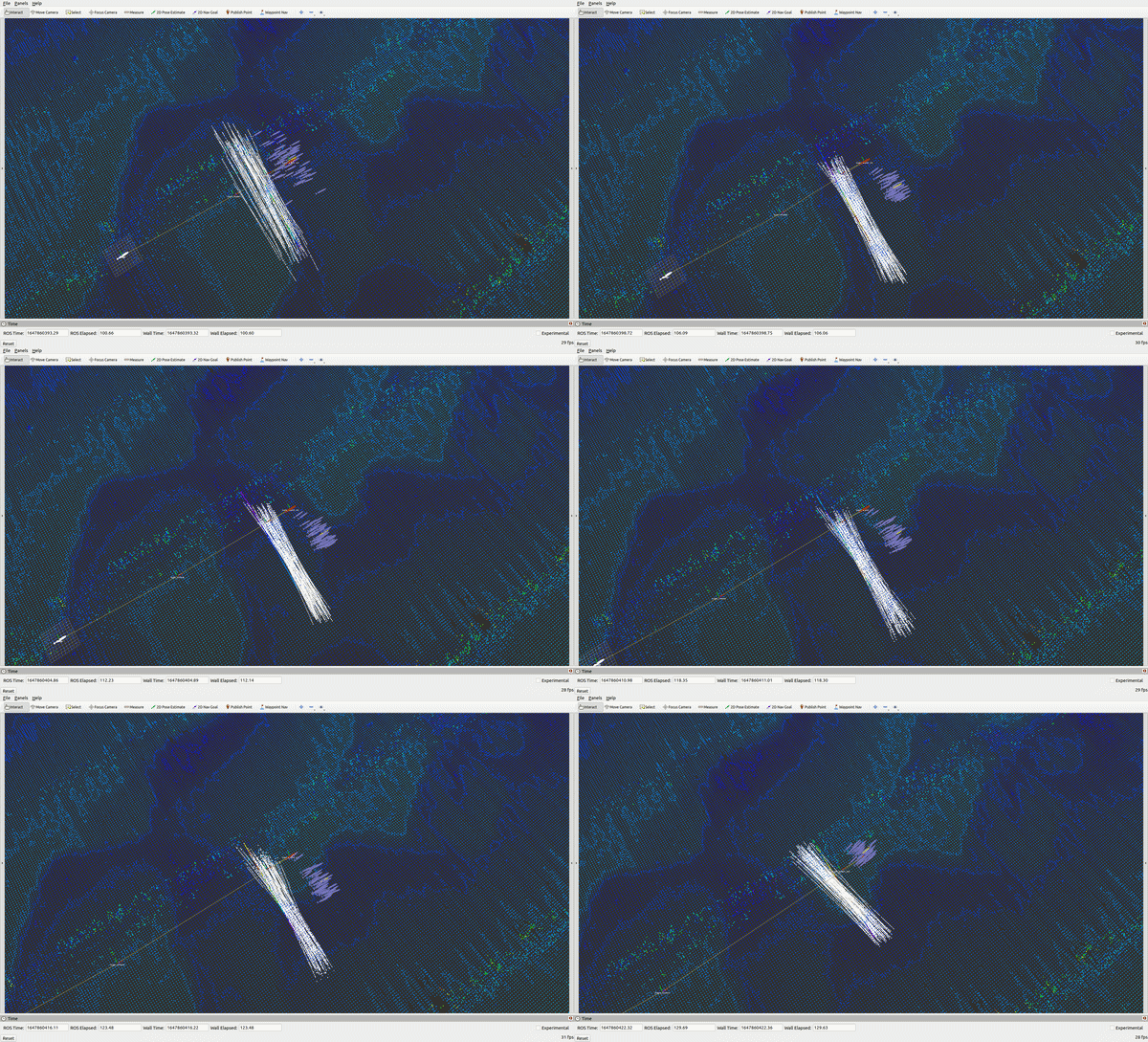
Where 0 is the number of the SVGP map you want to plot. Adjust the number of inducing points in this script to that used in the RBPF. The results will look like these (for 3 random particles)
Important: this is a very computationally heavy algorithm, tune it with care or your PC will run out of resources quickly. The params "particle_count" and "num_particle_handlers" will have a direct impact on the memory and GPU usage, so careful when instantiating them. The same applies to the SVGP parameters "svgp_num_ind_points" and "svgp_minibatch_size" and how often the filter prompts a loop closure detection "rbpf_period".
Currently porting Bathymetric SLAM into this framework.
