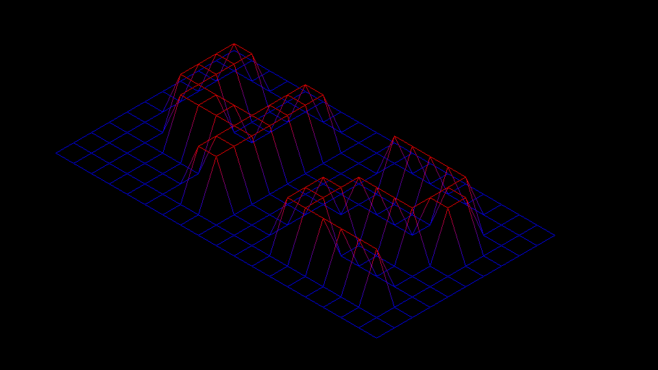
FDF is a 42 project that implements a 3D wireframe visualization of a grid, allowing users to explore and manipulate a 2D array of heights.
- 3D wireframe rendering of a height map
- Interactive controls for navigation and manipulation
To compile and run the FDF project, follow these steps:
1. Clone the repository:
Run the following command in your terminal:
git clone https://github.com/jelloster/fdf.git
2. Compile the project
Run the following command in the repository:
make
3. Run the program
You can run the program with either one of the test maps in the "test_maps" folder, or make your own! (See section: Making your own map below)
Example:
./fdf test_maps/42.fdf
You can move the map around the window using the arrow keys and zoom in and out using w and s. Esc closes the program.
Here are the requirements for your own map:
- The map has consistent row and column sizes.
- The map file ends with ".fdf".
- Only numeric values are used.
Here is an example map (test_maps/42.fdf) as seen in the picture at the top of the README:
0  0  0  0  0  0  0  0  0  0  0  0  0  0  0  0  0  0  0
0  0  0  0  0  0  0  0  0  0  0  0  0  0  0  0  0  0  0
0  0 10 10  0  0 10 10  0  0  0 10 10 10 10 10  0  0  0
0  0 10 10  0  0 10 10  0  0  0  0  0  0  0 10 10  0  0
0  0 10 10  0  0 10 10  0  0  0  0  0  0  0 10 10  0  0
0  0 10 10 10 10 10 10  0  0  0  0 10 10 10 10  0  0  0
0  0  0 10 10 10 10 10  0  0  0 10 10  0  0  0  0  0  0
0  0  0  0  0  0 10 10  0  0  0 10 10  0  0  0  0  0  0
0  0  0  0  0  0 10 10  0  0  0 10 10 10 10 10 10  0  0
0  0  0  0  0  0  0  0  0  0  0  0  0  0  0  0  0  0  0
0  0  0  0  0  0  0  0  0  0  0  0  0  0  0  0  0  0  0
