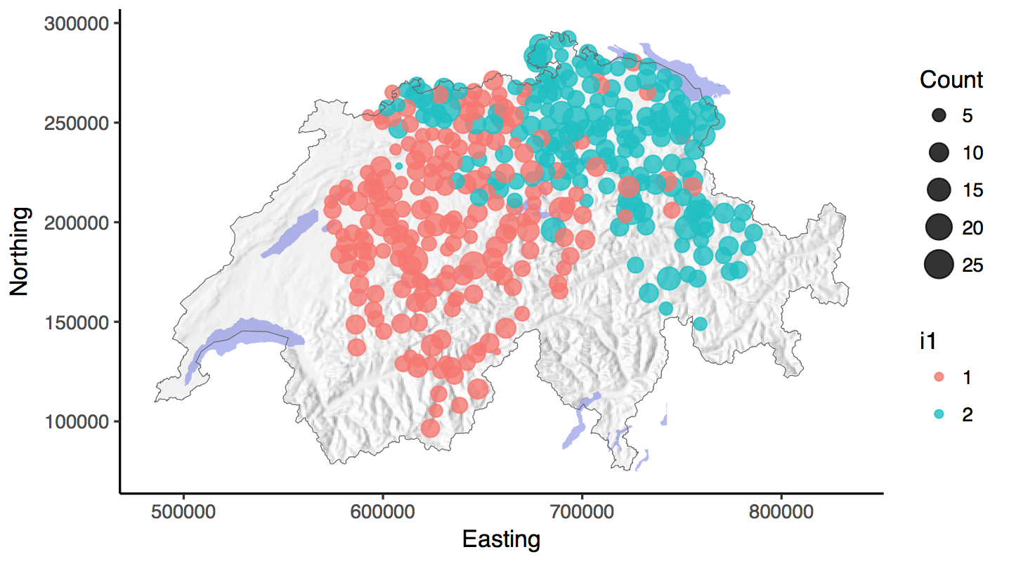
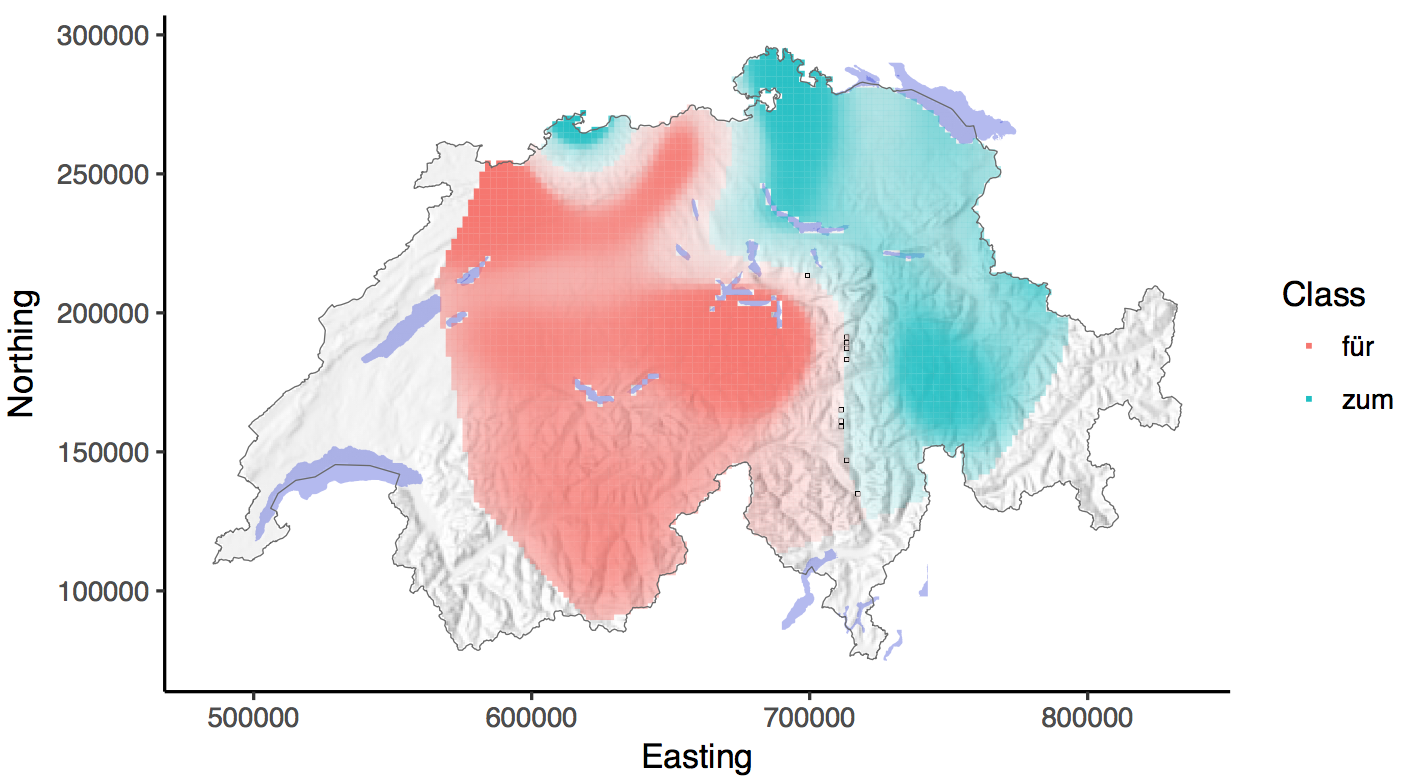
Generating continuous spatial surfaces for the manifestations and intensity of the 'infinitival complementizer' linguistic phenomena in the Swiss-German language (SADS phenomena I1, I6, I11 & IV14).
Detailed project report
 |
 |
|---|
In this project a new approach to model linguistic regions is presented. To study the spatial distribution of linguistic phenomena concepts from Geography are applied on a linguistic data set, which was collected in the project ‘Syntactic Atlas of German-speaking Switzerland’ (SADS) during the years 2000 till 2002. Continuous spatial surfaces for the manifestations and intensity of the 'infinitival complementizer' linguistic phenomena in the Swiss-German language are generated by combining techniques from machine learning, like the Support Vector Machine (SVM) and a spatial regularization of the classification map (MRF) with other well-known geographic concepts (Tobler’s first law, hiking function and least cost paths) to create linguistic regions, which take the inherent spatial dependencies between the data points into account. Trudgill's gravity index finds application to weight the linguistic influence of two neighbouring points on each other.
The project is supervised by Curdin Derungs, head of the GISLab, a research group of the ‘UFSP Language and Space’ initiative at the University of Zurich.
- Install R & RStudio
- Get the needed libraries:
install.packages('library-name') - Clone the repository, by creating a new git project in RStudio
- DHM200 - Digital elevation model - swisstopo
- SADS - Syntactic Atlas of German-speaking Switzerland - UFSP SpuR
- STATPOP - Statistics of the Swiss population - Federal Statistical Office
- swissBOUNDARIES3D - Swiss national border - swisstopo
- Fork it!
- Create your feature branch:
git checkout -b my-new-feature - Commit your changes:
git commit -am 'Add some feature' - Push to the branch:
git push origin my-new-feature - Submit a pull request :D
- Merlin Unterfinger - Development and implementation - munterfi
- Curdin Derungs - Theoretical background - GISLab
- R - The R Project for Statistical Computing
- RStudio - Open source and enterprise-ready professional software for R
This project is licensed under the MIT License - see the LICENSE file for details
Besag, J. (1986). On the Statistical Analysis of Dirty Pictures. Journal of the Royal Statistical Society, 48(3):259–302.
Beygelzimer, A., Kakadet, S., Langford, J., Arya, S., Mount, D., and Li, S. (2013). FNN: Fast Nearest Neighbor Search Algorithms and Applications.
Bivand, R., Keitt, T., and Rowlingson, B. (2016). rgdal: Bindings for the Geospatial Data Abstraction Library.
Bivand, R. and Rundel, C. (2016). rgeos: Interface to Geometry Engine - Open Source (GEOS).
Bivand, R. S., Pebesma, E., and Gomez-Rubio, V. (2013). Applied spatial data analysis with {R}, Second edition. Springer, NY.
Bucheli, C. and Glaser, E. (2002). The Syntactic Atlas of Swiss German Dialects: Empirical and Methodological Problems. In Barbiers, S., Cornips, L., and van der Kleij, S., editors, Syntactic Microvariation, pages 41–73. Meertens Institute Electronic Publications in Linguistics, Amsterdam, 2 edition.
Geman, S. and Geman, D. (1984). Stochastic Relaxation, Gibbs Distributions, and the Bayesian Restoration of Images. IEEE Transactions on Pattern Analysis and Machine Intelligence, 6(6):721–741.
Jeszenszky, P. and Weibel, R. (2016). Modeling transitions between syntactic variants in the dialect continuum. In The 19th AGILE International Conference on Geographic Information Science, Helsinki (Finnland), 14 June 2016 - 17 June 2016, number June.
Karatzoglou, A., Meyer, D., and Hornik, K. (2006). Support Vector Algorithm in R. Journal of Statistical Software, 15(9):1–28.
Metropolis, N., Rosenbluth, A. W., Rosenbluth, M. N., Teller, A. H., and Teller, E. (1953). Equation of state calculations by fast computing machines. Journal Chemical Physics, 21(6):1087–1092.
Meyer, D., Dimitriadou, E., Hornik, K., Weingessel, A., and Leisch, F. (2015). e1071: Misc Functions of the Department of Statistics, Probability Theory Group (Formerly: E1071), TU Wien.
Pebesma, E. J. and Bivand, R. S. (2005). Classes and methods for spatial data in {R}. R News, 5(2):9–13.
Perpiñán, O. and Hijmans, R. (2016). rasterVis.
R Core Team (2016). foreign: Read Data Stored by Minitab, S, SAS, SPSS, Stata, Systat, Weka, dBase, ... R package version 0.8-67.
Tarabalka, Y., Fauvel, M., Chanussot, J., and Benediktsson, J. A. (2010). SVM and MRF-Based Method for Accurate Classification of Hyperspectral Images. IEEE Geoscience and Remote Sensing Letters, 7(4):736–740.
Tobler, W. (1993). Non-Isotropic Geographic Modeling. NCGIA Technical Reports, 93(1):5.
Trudgill, P. (1974). Linguistic change and di usion: description and explanation in sociolinguistic dialect geography. Language in Society, 2:215–246.
van Etten, J. (2017). {R} Package {gdistance}: Distances and Routes on Geographical Grids. Journal of Statistical Software, 76(13):1–21.
Wickham, H. (2009). ggplot2: Elegant Graphics for Data Analysis. Springer-Verlag New York.