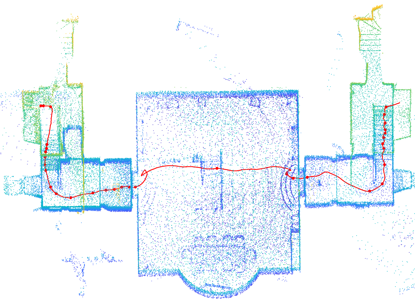
DMSA LiDAR SLAM is a robust and accurate package for LiDAR and IMU based mapping. First point clouds within a sliding time window are optimized conjointly with so called static points from the map and IMU measurements. When a new keyframe is added to the map, related keyframes are optimized. Keyframes are stored in a ring buffer, therefore old keyframes are deleted from a certain map size. For point cloud alignment, Dense Multi Scan Adjustment (DMSA) is used. Details can be found in our paper (preprint, accepted for ICRA 2024).
The use of IMU data is not mandatory, but recommended.
Fig.1 - Resulting keyframe point cloud of sequence exp14 Basement of the Hilti-Oxford Dataset. The estimated trajectory is marked with a red line. Fig.2 - Running DMSA SLAM on the stairs sequence of the Newer College Dataset.The package is primarily designed as an offline mapping module and the default parameters are optimized towards robustness and accuracy. The processing speed is highly dependent on the hardware used and the data acquisition environment. Typical processing times are 2-3 times the recording time.
Note: In order to publish the software under the MIT license, a different type of interpolation was used to calculate the dense trajectory poses, in contrast to the published paper. While Cubic Hermitian spline interpolation was used for the results published in the paper, in the published software Barycentric Rational interpolation is used. This change and the continuous development of the software may lead to minor deviations in accuracy compared to the published results.
Input: Rosbag with LiDAR (PointCloud2-Messages) and IMU data
Output: Trajectory as Pose.txt file (TUM-format) and resulting keyframe point cloud as .pcd file
The package can work with LiDAR data from the following manufacturers (the ROS drivers must be configured in such a way that time stamp and ring id are provided for each point):
- Ouster
- Hesai
- Velodyne
- Robosense
- (Livox)
Info for Livox-LiDARs: The point clouds from Livox-LiDARs are at the moment not directly supported, but can be processed if the point clouds are recorded as PointCloud2-messages using the setting sensor: "unknown". It is also recommended to change the following parameter in config/slam_settings.yaml to max_num_points_per_scan: 1500 to obtain better results with sparse Livox point clouds.
-> If someone can provide a rosbag (1-2 min, with motion) with Livox point clouds in the PointCloud2 PointXYZRTLT format (see livox_ros_driver2), then I will integrate a separate Livox configuration into the software.
The package was developed with the following packages:
- Ubuntu 20.04
- ROS Noetic
- Eigen 3.4.0
Compatibility with other Ubuntu/ROS/Eigen versions should be possible, but has not been tested.
Instructions for installing ROS Noetic can be found here.
Unfortunately, Eigen 3.4.0 is not available via apt package management on Ubuntu 20.04. You can download the latest Eigen version from here and follow the instructions.
You can also use the provided shell script, that will update your Eigen version to 3.4.0 on Ubuntu 20.04:
sh helpers/updateEigenUbuntu20.04.sh
mkdir catkin_ws
cd catkin_ws && mkdir src && cd src
git clone https://github.com/davidskdds/DMSA_LiDAR_SLAM.git
cd .. && catkin_make
The main SLAM settings are defined in config/slam_settings.yaml and should not have to be adjusted.
The following changes are made in config/custom.yaml, config/hilti2022.yaml, config/Ouster_LiDAR_NewerCollege_64.yaml or config/Ouster_LiDAR_NewerCollege_128.yaml
The software processes the data directly from the Rosbag, there is no need to run "rosbag play ...". The path to the Rosbag must be specified to process the data.
A Rosbag path could look like this:
bag_dirs: "/home/user_name/recording.bag"
Several Rosbags can also be processed directly one after the other. To do this, the rosbag names are separated by spaces:
bag_dirs: "/home/username/recording1.bag /home/username/recording2.bag"
Attention: The path to a Rosbag or the Rosbag file name must not contain a space character
By default, the software cyclically saves the current poses (as Poses.txt file) and the current keyframe point cloud (as PointCloud.pcd). The files are overwritten cyclically so that the latest data is always saved. It is recommended to use home directory (or another folder within home directory) to prevent permission issues. The parameter could be set like this:
result_dir: "/home/USERNAME"
3. LiDAR and IMU Settings (not necessary for benchmark dataset configurations like Hilti and Newer College)
Regarding the LiDAR the sensor type {"hesai","ouster","robosense","velodyne","unknown"} and the lidar_topic must be specified in the .yaml file.
For using an IMU the imu_topic and the extrinsics must be specified (see .yaml file). It is also possible to run DMSA-SLAM without IMU data. To do so, set use_imu: false.
source devel/setup.bash
roslaunch dmsa_slam_ros hilti_2022.launch
or
roslaunch dmsa_slam_ros custom.launch
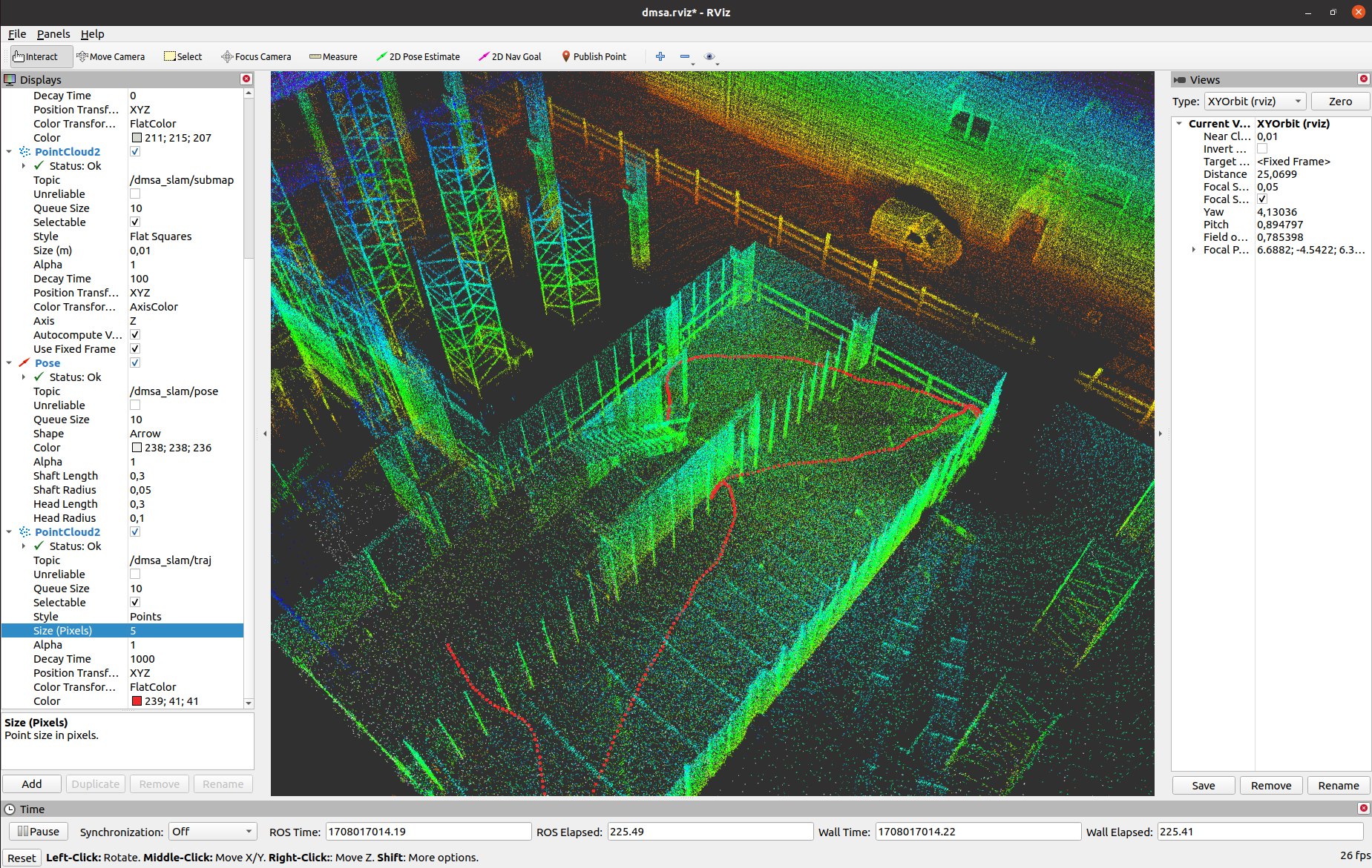
After the package is started, RViz opens and displays the progress of the processing. In RViz the current pose (white), the processed submap point clouds, map points (grey) and the trajectory (red) are shown.
Fig.3 - DMSA-SLAM in RViz.

