Jakarto datasets for 3d detection challenge of urban assets


We built that python API to share some real-world 3d lidar datasets of urban assets. We hope to help some of you to develop and test algorithms about 3d lidar processing.
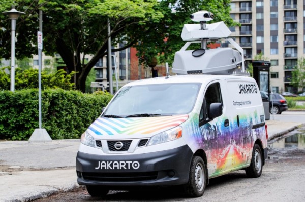
Those datasets have been gathered with the Jakarto truck.
Installation
This API requires python 3.6+.
pip install jakarto-datasetsUsage
from jakarto_datasets.datasets.storm_drains import StormDrainsDataset

# Load dataset
storm_drains_2019 = StormDrainsDataset()

for data in storm_drains_2019.training_set:
    coordinates = data.get_coordinates_data()
    lidar_data = data.get_lidar_data()

    label = data.get_label_lidar_data()

    print(data)
    print(coordinates.shape)
    print(lidar_data.shape)
    print(label.shape)

    print(lidar_data['intensity'])
Datasets
| datasets | year | size | 3d lidar | label | raster | mask | len(training_set) |
len(testing_set) |
examples |
|---|---|---|---|---|---|---|---|---|---|
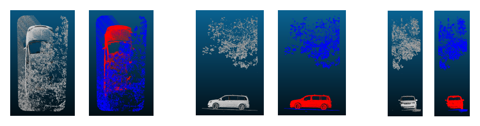
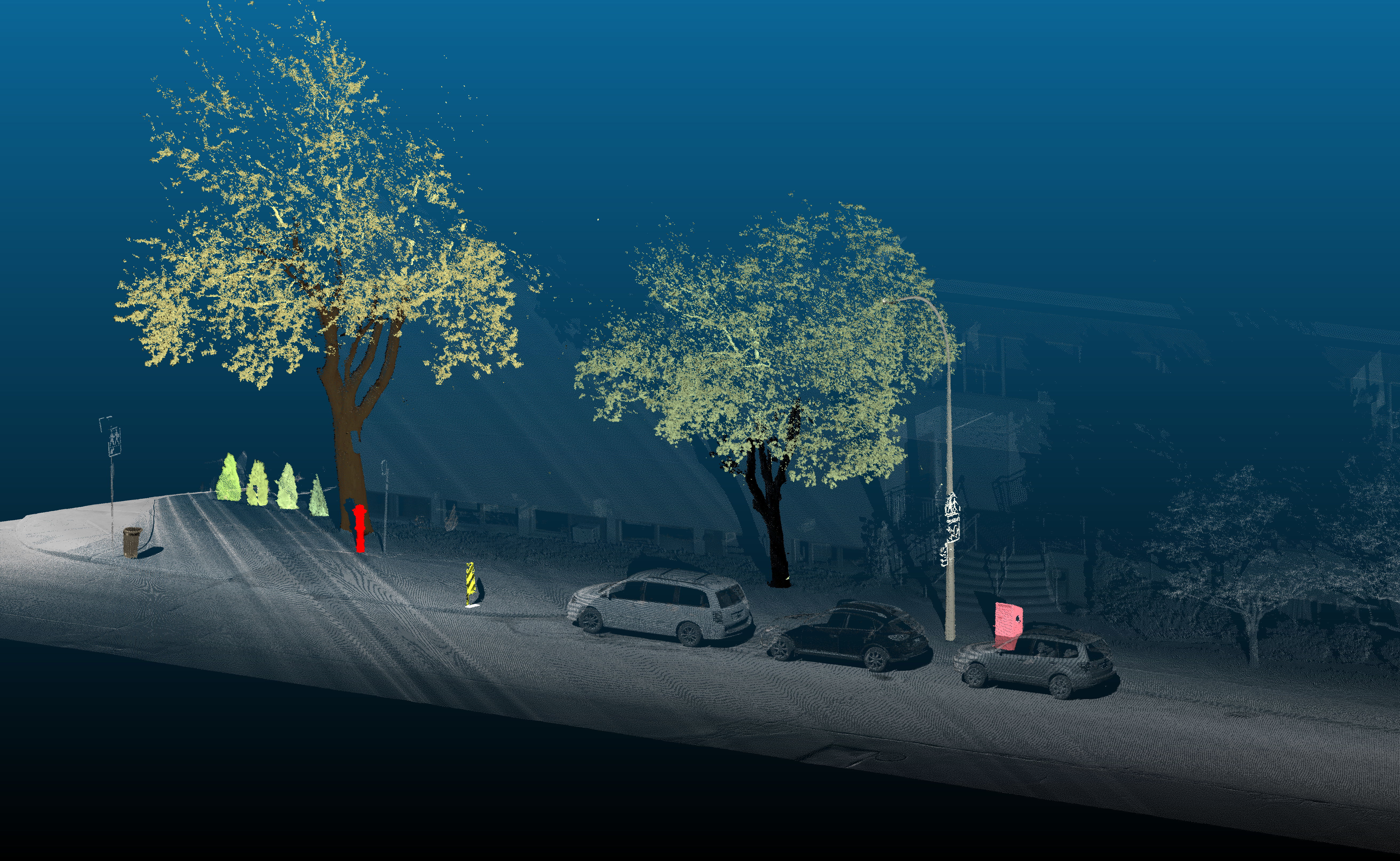
| storm drains | 2019 | 2,29 Go | ✔️ | ✔️ | ✔️ | ✔️ | 223 | 150 | see examples |
Benchmarks
We will be more than happy to share your experiments.
| datasets | title | authors | links | description |
|---|---|---|---|---|
| storm drains 2019 | balanced random forest | Jakarto team | link | Use a deadly simple balanced random forest to classify each point from lidar data. Although it doesn't use spatial information, it allowed Jakarto to detect ~25% of storm drains. Those storm drains will be added to the Jakarto storm drains 2020 dataset. |
| ... | ... | ... | ... |
Citation
If you find this work useful and wish to refer to, please consider the following BibTeX entry:
@MISC{jakarto_datasets,
    author = {Loic Messal and Cedric Pelletier},
    title = {Jakarto datasets},
    year = {2019},
    howpublished={\url{https://github.com/jakarto3d/jakarto_datasets}}
}
A github star may also help.
Contact
If you want to email us, please send an email to contact@jakarto.com.
License
This project is licensed under the terms of the MIT license. (see LICENSE.txt file for details).